MISR Regional UAE2 Products |
 |
MISR Regional Imagery: Overview | Products | Data Quality | Map Projection | File Format | View Data | Download Data
There are currently three types of MISR Regional products: Radiance, Aerosol, and Land Surface. Each product summarizes one category of parameters. For those familiar with the MISR Level 1 and 2 products, this maps directly to those products; each Regional product summarizes selected parameters from one Level 1 or Level 2 product.
Further information about the Level 1 and Level 2 products can be found at the MISR Data and Information, and by consulting the Algorithm Theoretical Basis Documents.
Images available on this web site include the following parameters:
|
Component Global Georectified Radiance Product (CGGRP): UAEMRDRD, UAEMRMRD, UAEMRQRD |
||
|---|---|---|
| Parameter | Definition | Sample |
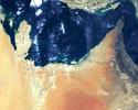
| Radiance |
Radiance data for 4 MISR Bands and 9 MISR view angles.
For those familiar with the MISR Level 1 products, this is a summary of GRP_TERRAIN and GRP_ELLIPSOID (GRP_TERRAIN over the land, GRP_ELLIPSOID over the ocean), Radiance/RQI field. |
 |
|
Component Global Aerosol Product (CGAS): UAEMRDAE, UAEMRMAE, UAEMRQAE |
||
| Parameter | Definition | Sample |
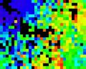
| Optical depth |
Aerosol optical depth. This is for the green (555 nm) band.
For those familiar with the MISR Level 2 products, this is a summary of AS_AEROSOL, RegMeanSpectralOptDepth field. |
 |
|
Component Global Land Surface Product (CGLS): UAEMRDLS, UAEMRMLS, UAEMRQLS |
||
| Parameter | Definition | Sample |
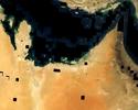
| DHR |
Directional Hemispheric Reflectance (DHR). This is the spectral albedo of the surface in the absence of the atmosphere. Also known as the "black sky" albedo.
For those familiar with the MISR Level 2 products, this is a summary of AS_LAND, LandDHR field. |
 |
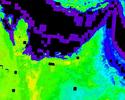
| DHRPAR |
DHR integrated over the Photosynthetically Active Radiation (PAR) band.
For those familiar with the MISR Level 2 products, this is a summary of of AS_LAND, DHRPAR field. |
 |
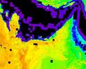
| DHRSW |
DHR for a broad shortwave band (400-2500 nm), approximated from visible bands.
For those familiar with the MISR Level 2 products, this this is derived from a linear combination of MISR bands found in AS_LAND, DHR field. See Hemispherical reflectance and albedo estimates from the accumulation of across-track sun-synchronous satellite data, Weiss M, Baret F, Leroy M, Begue A, Hautecoeur O, Santer R, JOURNAL OF GEOPHYSICAL RESEARCH-ATMOSPHERES 104: (D18) 22221-22232 SEP 27 1999. |
 |
| FPAR |
Fractional absorbed Photosynthetically Active Radiation (FPAR). Defined as PAR irradiance absorbed by live vegetation divided by incident PAR irradiance.
For those familiar with the MISR Level 2 products, this is a summary of AS_LAND, FPARBestEstimate field. |
 |
| LAI |
Leaf Area Index (LAI).
For those familiar with the MISR Level 2 products, this is a summary of AS_LAND, LAIBestEstimate. |
 |
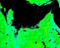
| NDVI |
Normalized Difference Vegetation Index (NDVI).
For those familiar with the MISR Level 2 products, this is a summary of of AS_LAND, NDVI field. |
 |