Studying the 2019-2020 Australian Bushfires Using NASA Data StoryMap
Studying the 2019-2020 Australian Bushfires Using NASA Data StoryMap
In partnership between NASA Langley Research Center's Atmospheric Science Data Center, Science Directorate, and the NASA Disasters Program.
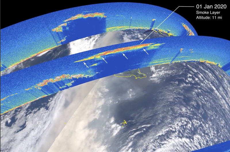
The Atmospheric Science Data Center (ASDC)'s Science Outreach Team has made an interactive ArcGIS StoryMap entitled Studying the 2019-2020 Australian Bushfires Using NASA Data, which was created in collaboration with representatives from the Langley Science Directorate and NASA Disasters Program. This StoryMap focuses on the contributing climate factors, atmospheric effects, and public health impacts of the 2019-2020 Australian Bushfires. The 2019-2020 fire season was one of the most intense on record, and the StoryMap provides information about the factors leading up to the fires, effects on global and local atmospheric composition, and how smoke from fires affects public health. Users can explore the combination of interactive data resources, visualizations of scientific phenomenon, and science storytelling to study various aspects of the fires.
Photo Credits: NASA/CALIPSO
Published in August 2020.