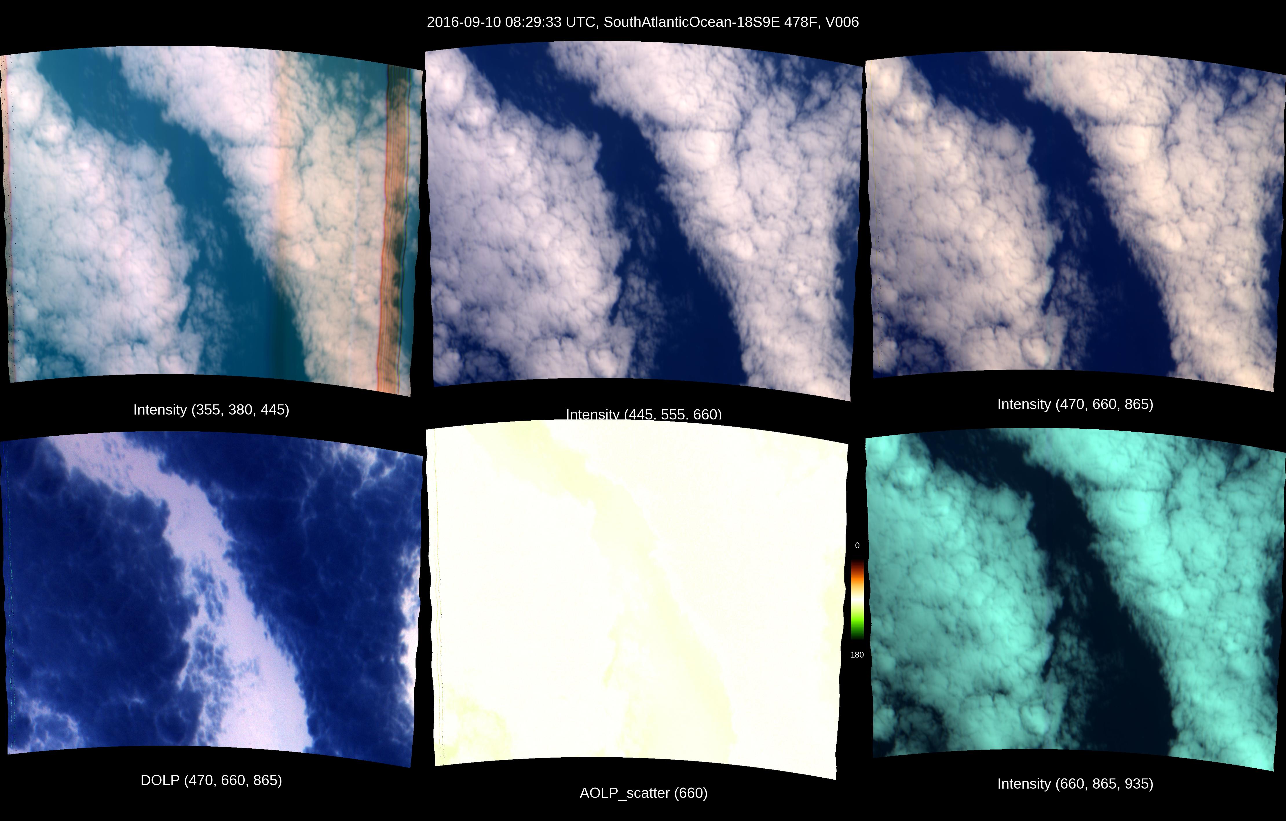
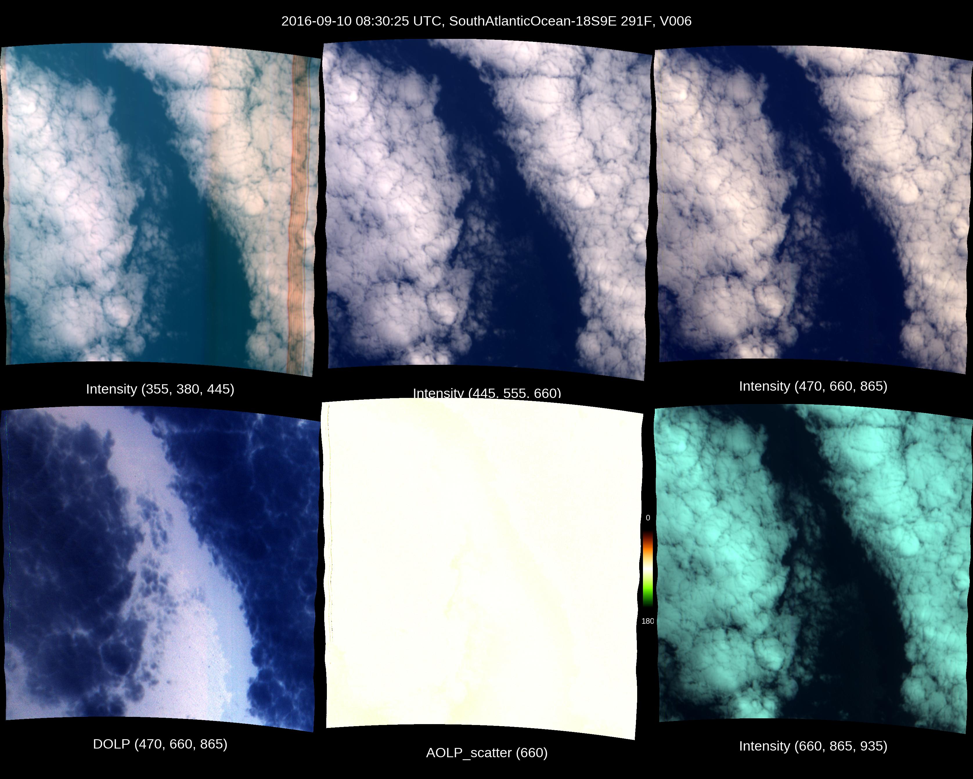
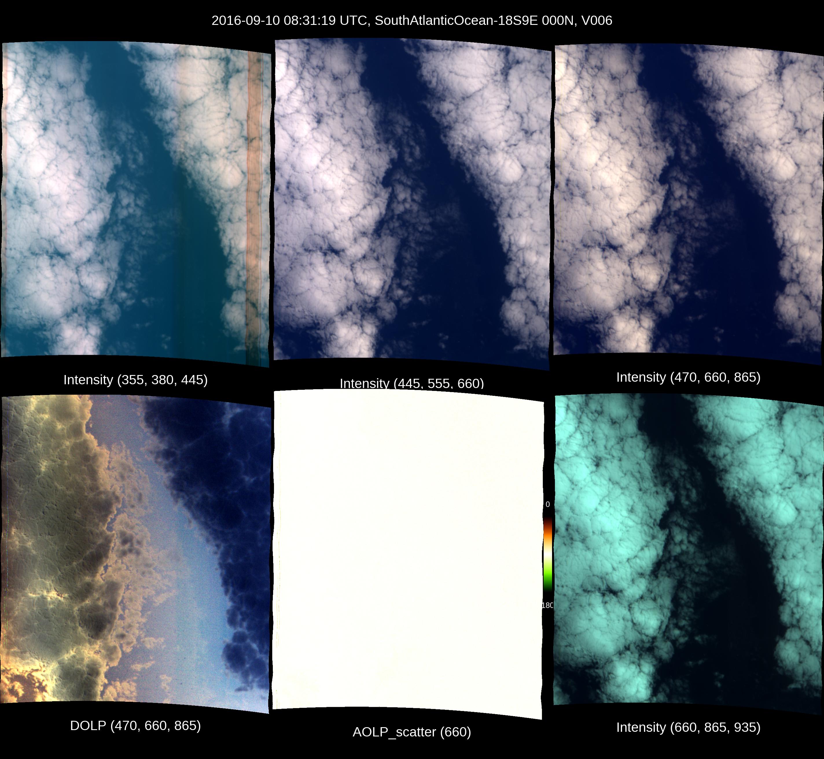
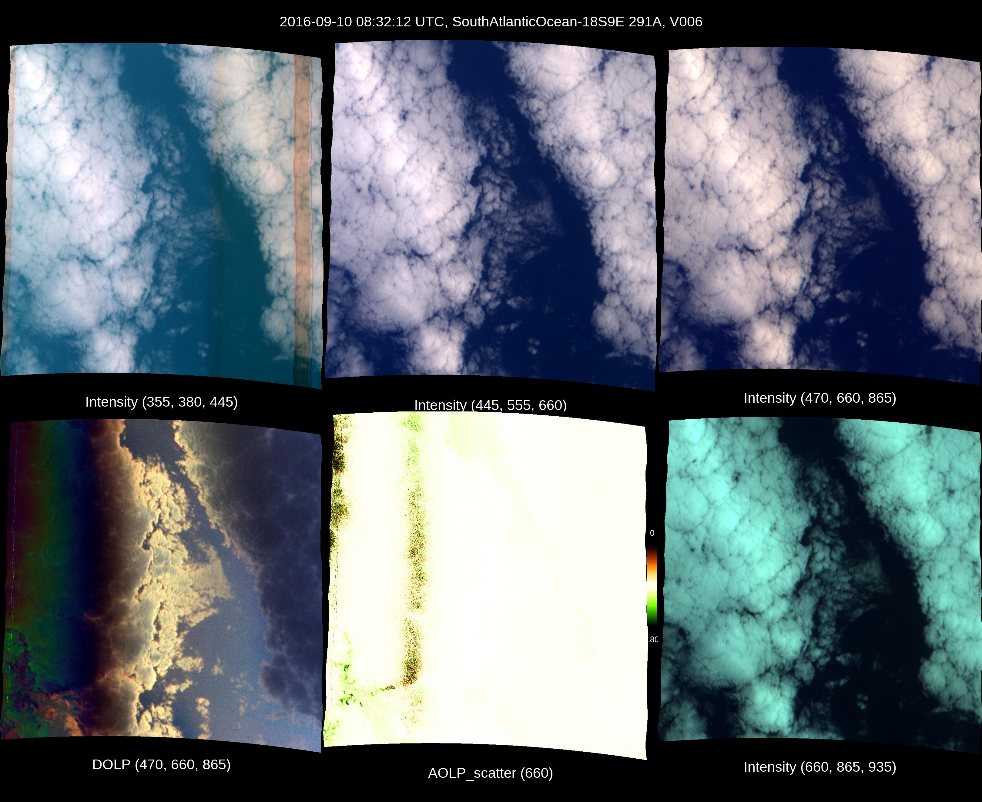
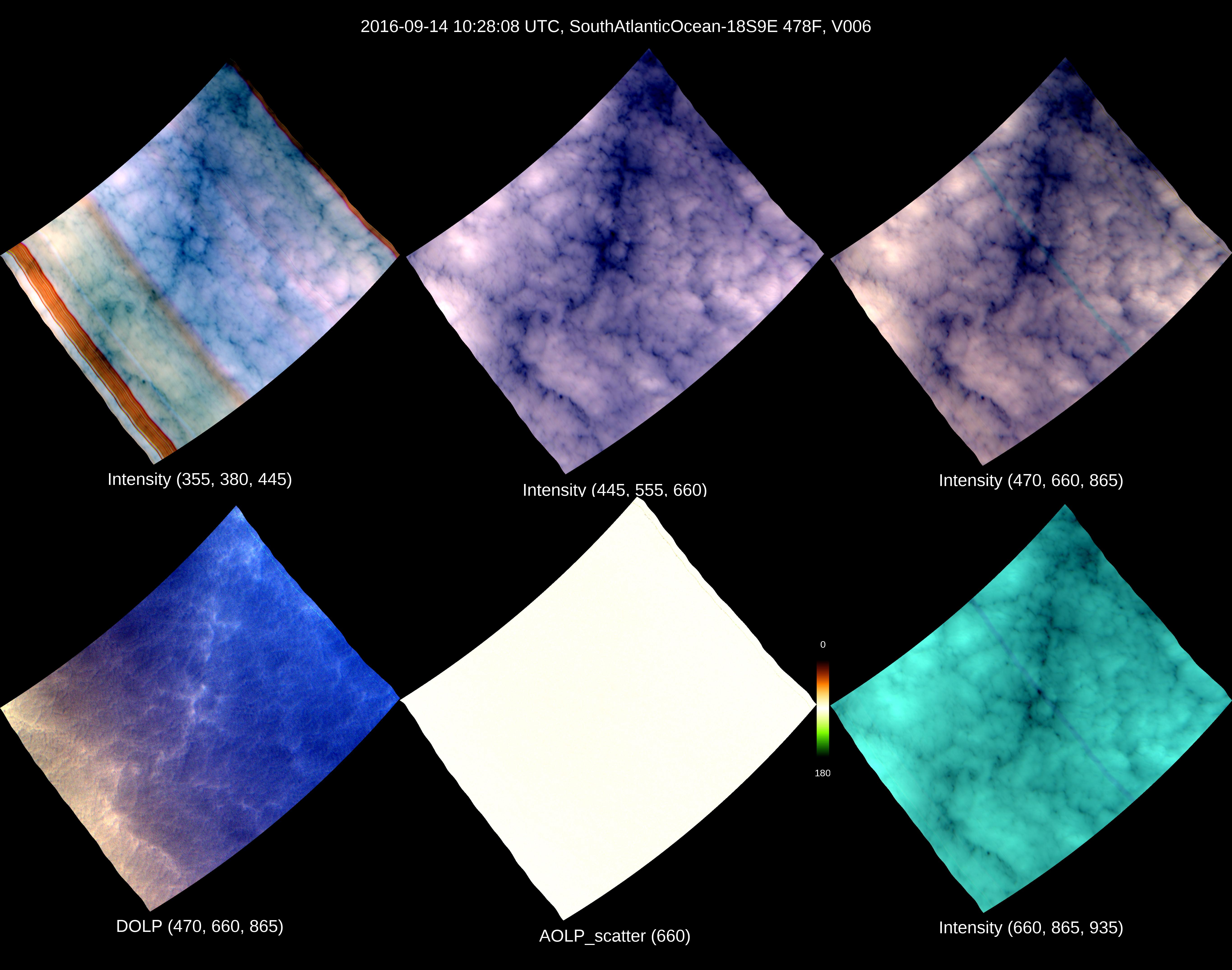
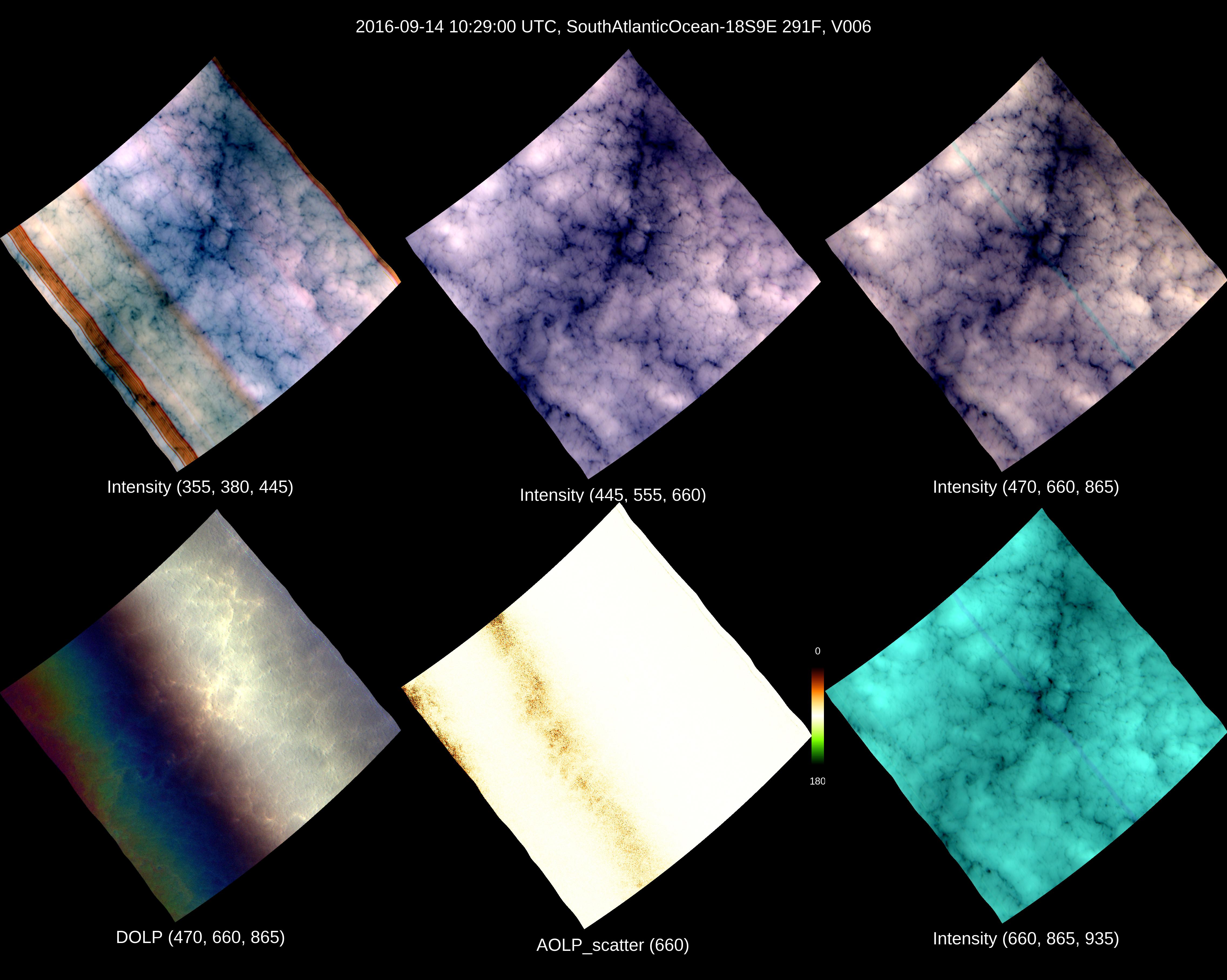
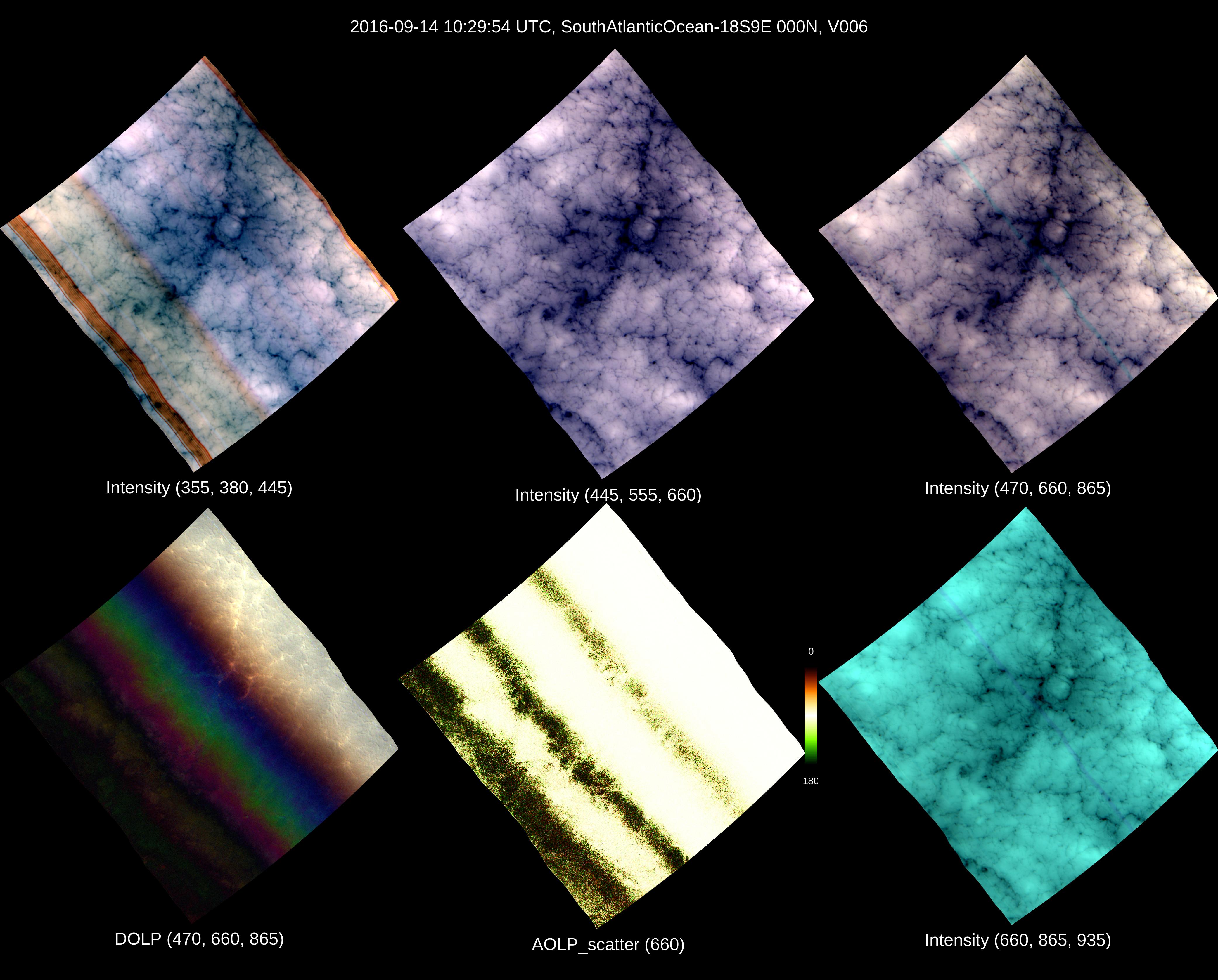
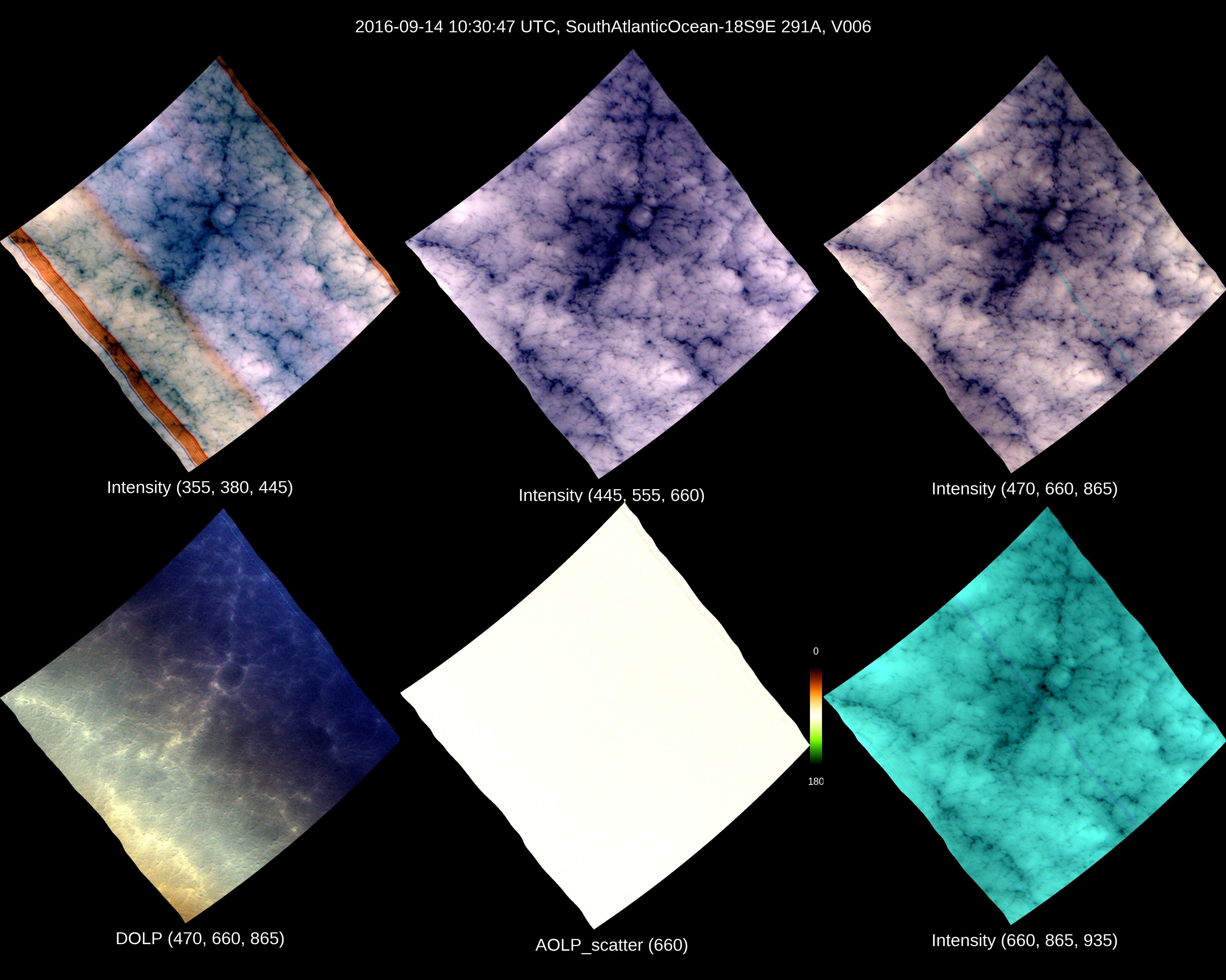
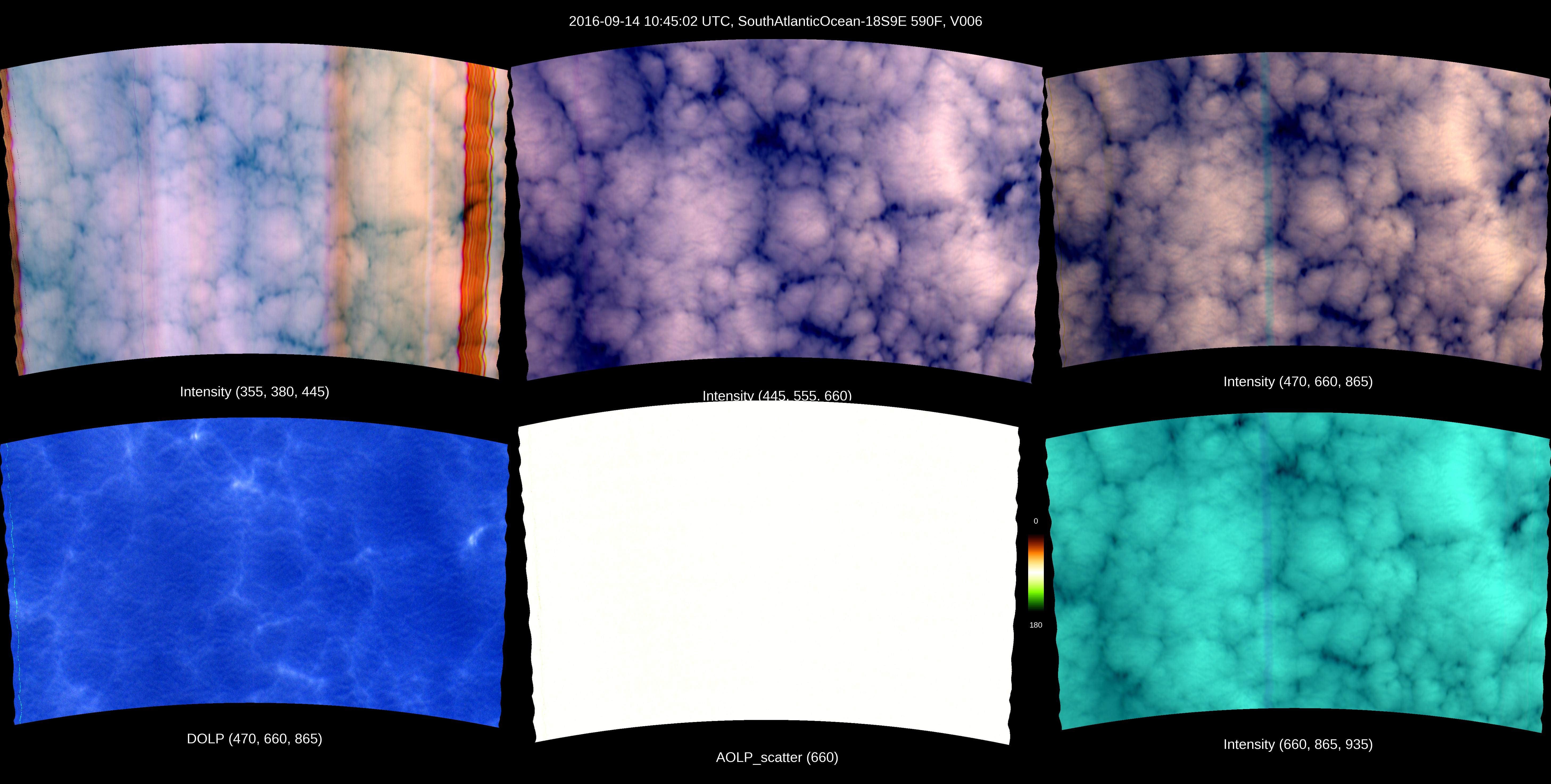
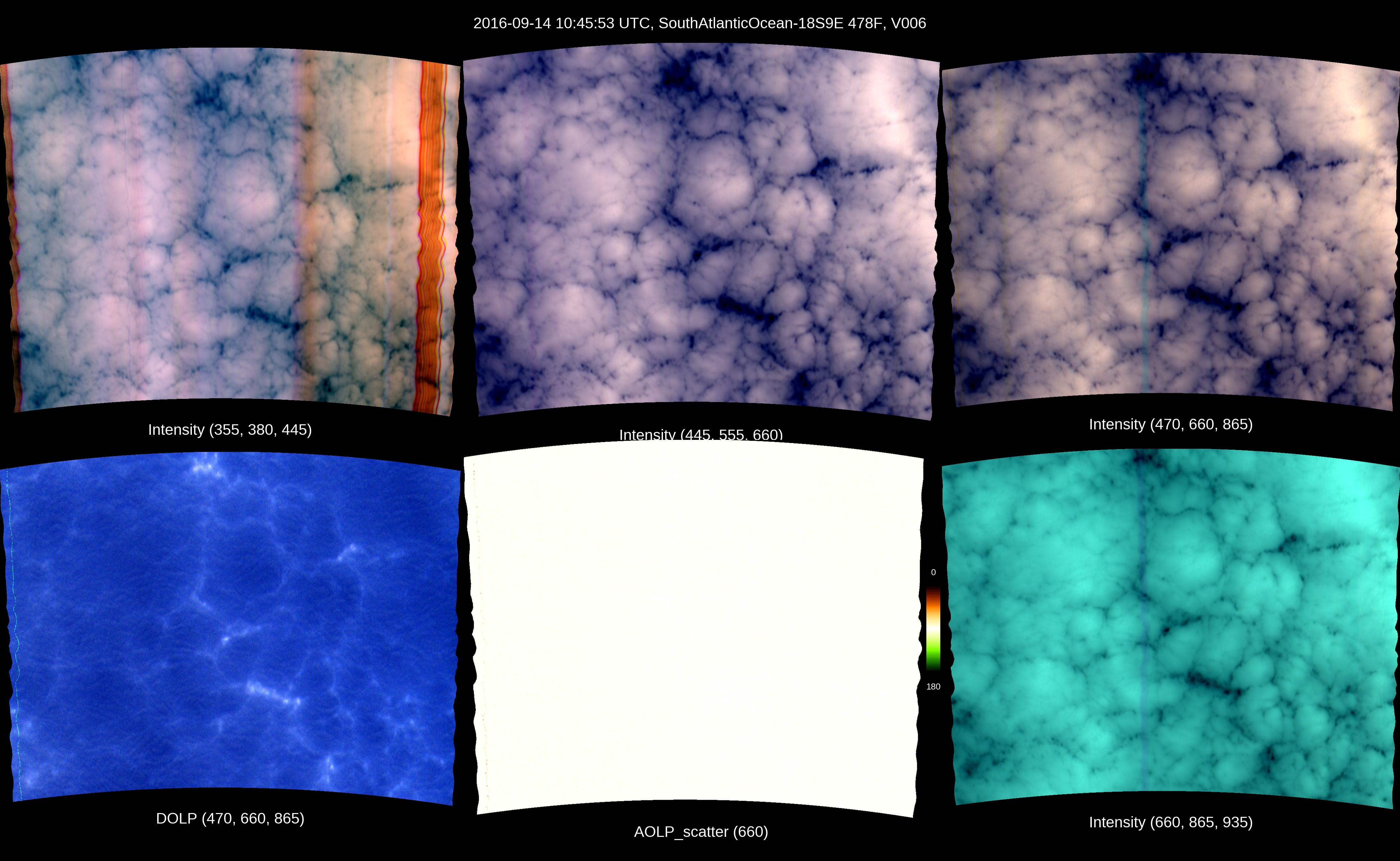
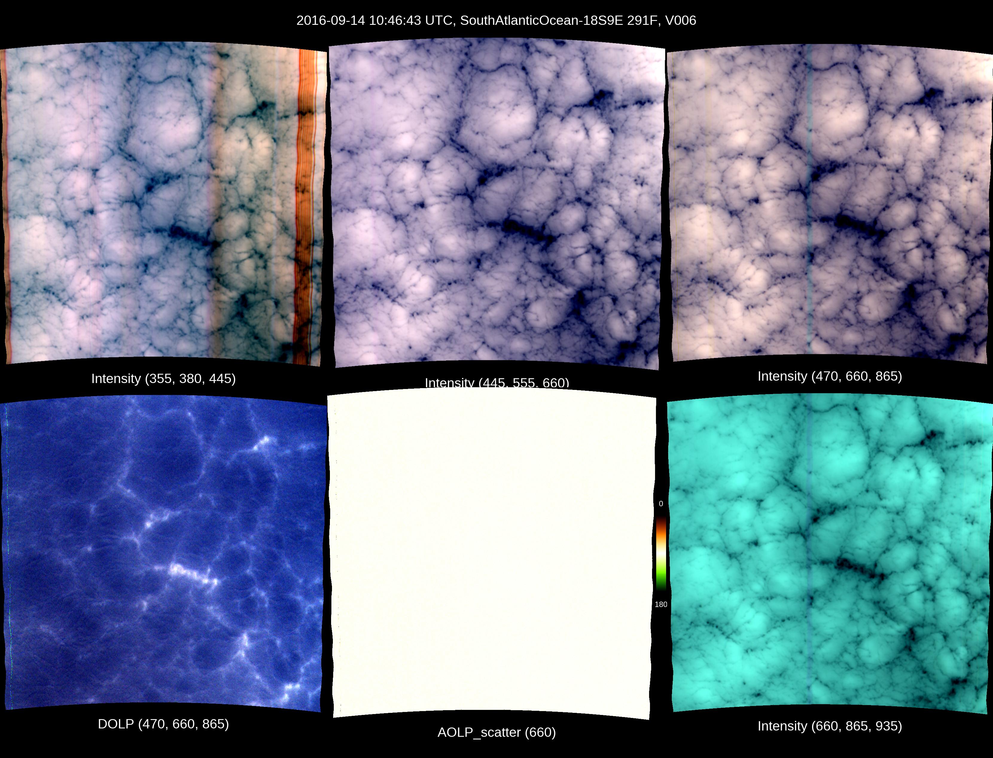
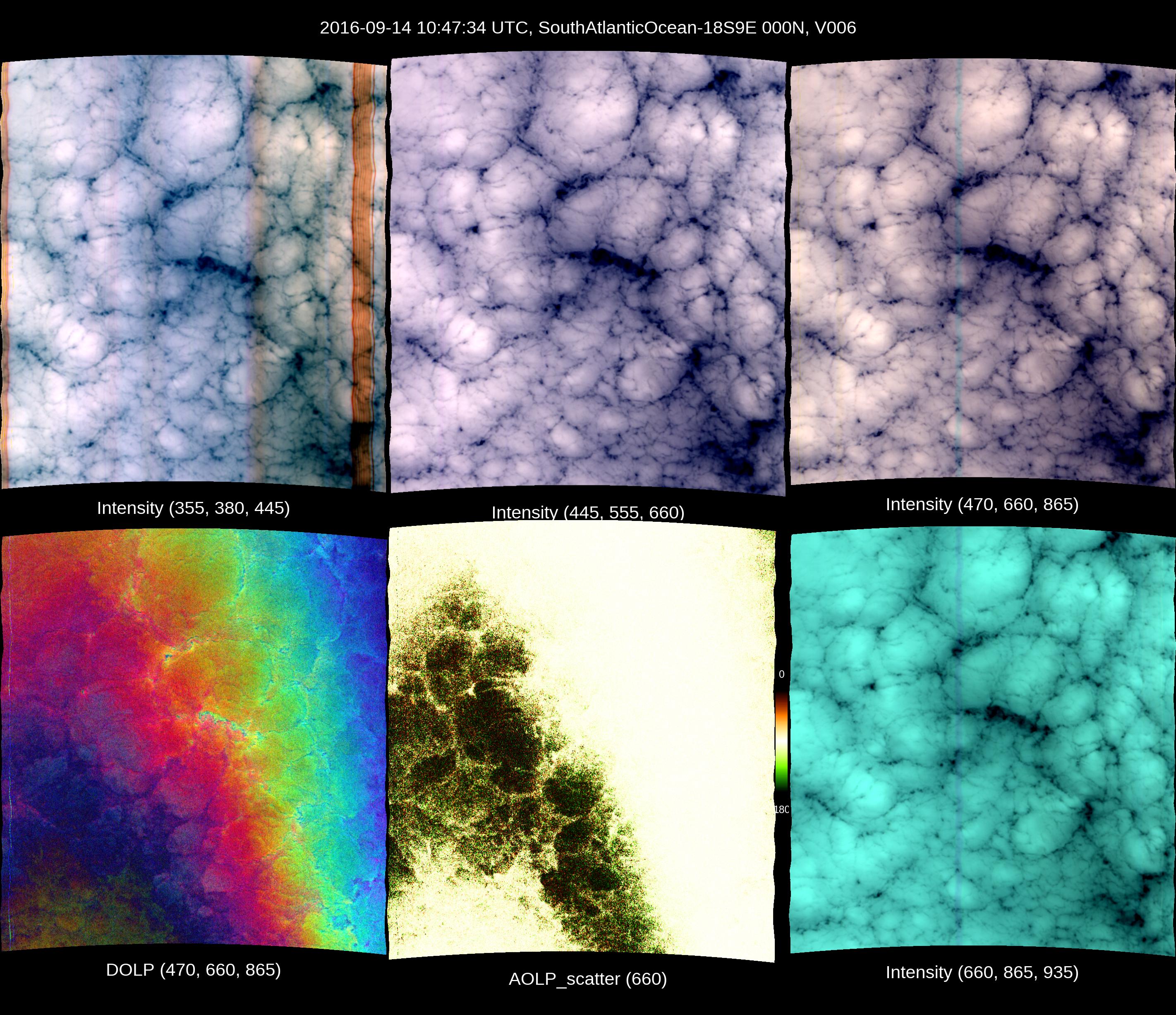
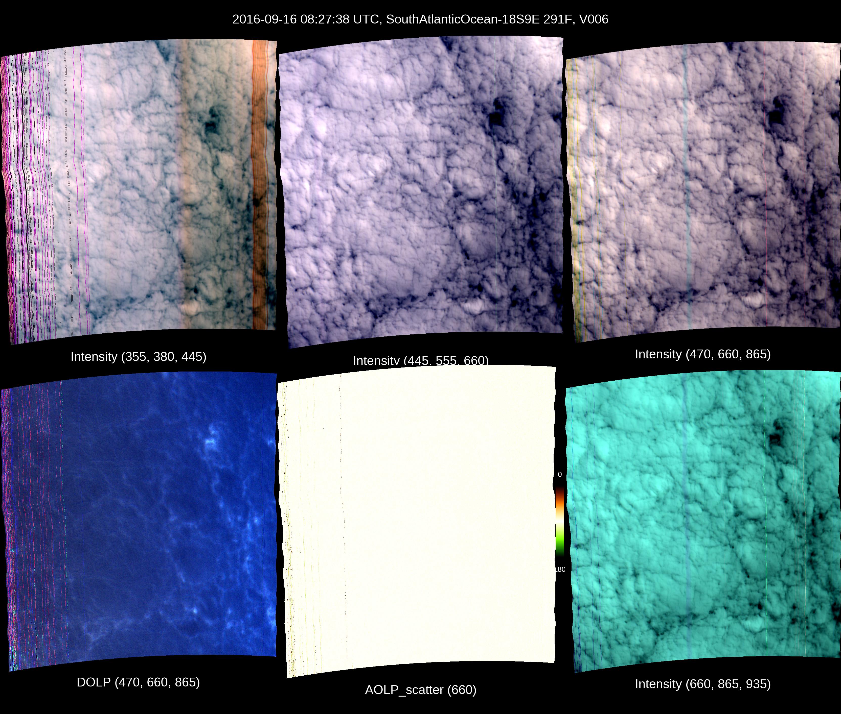
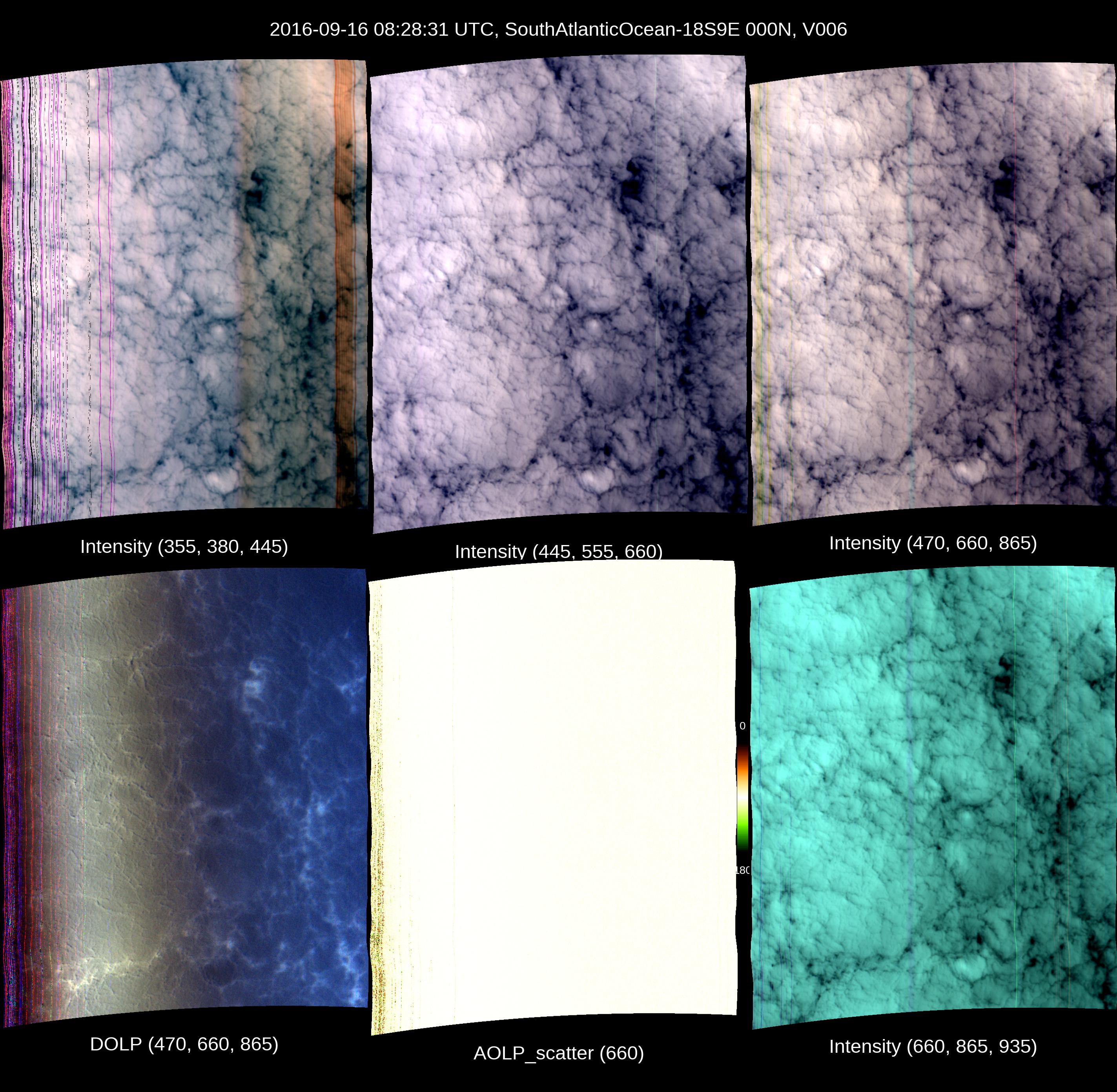
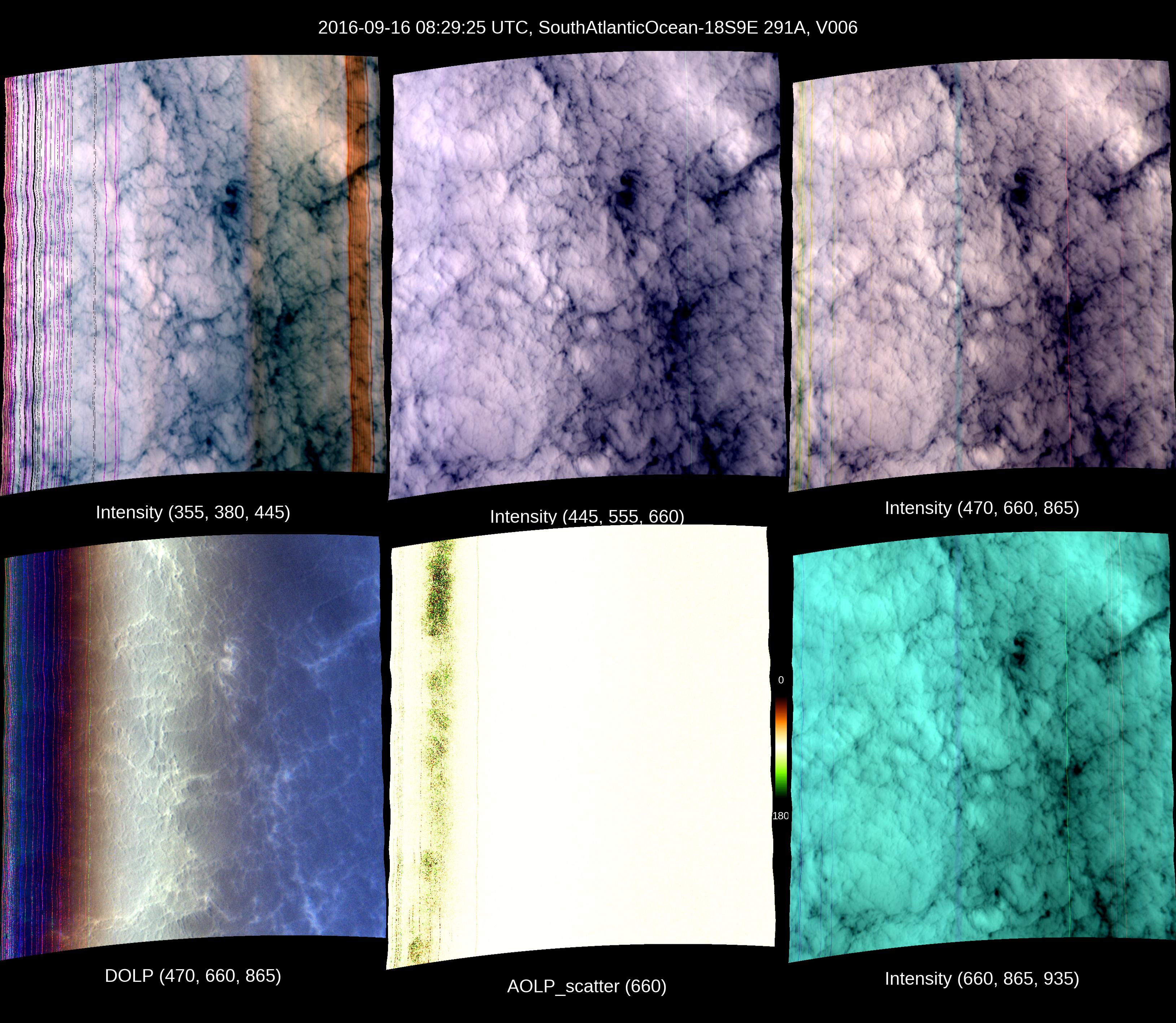
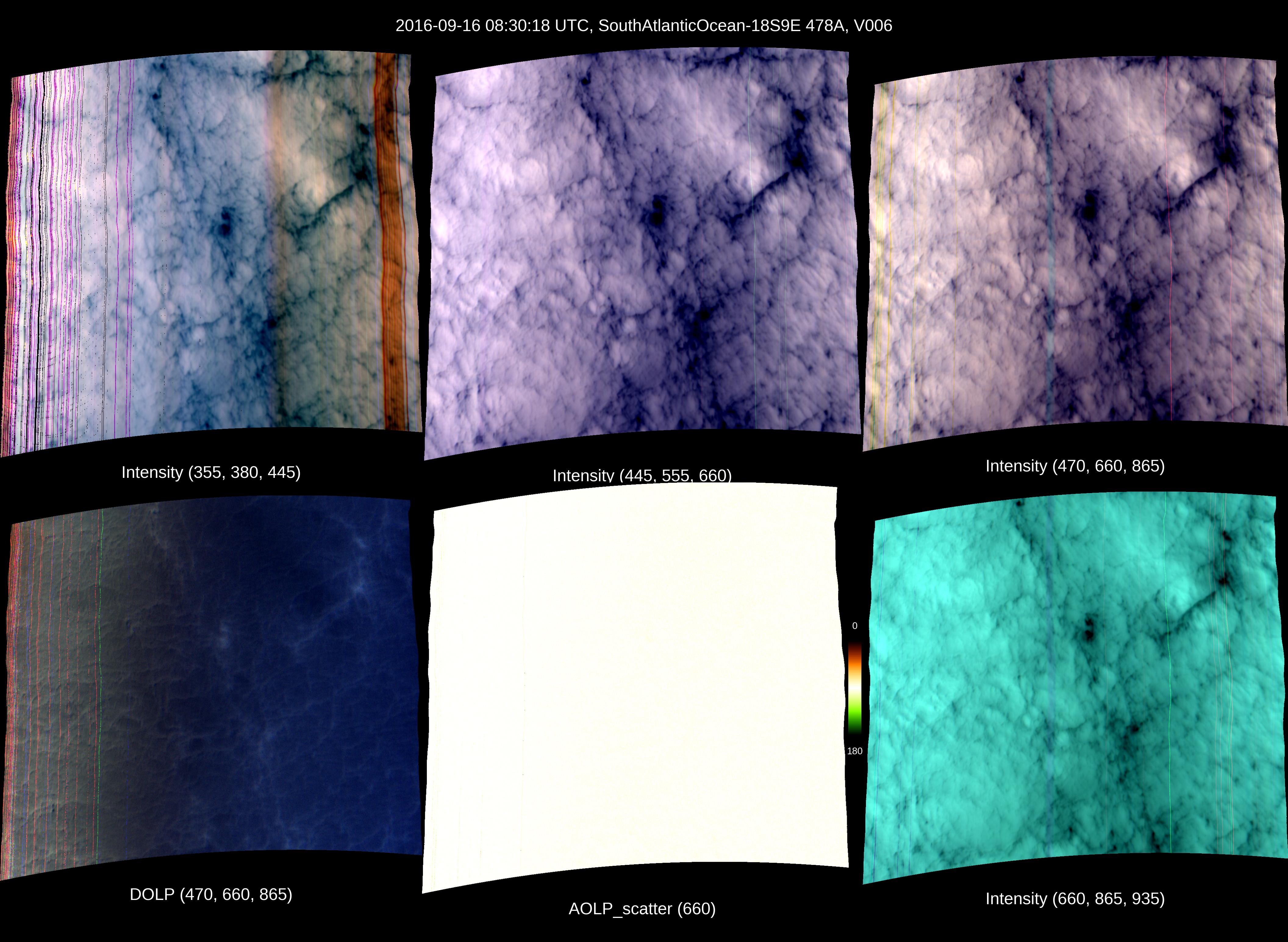
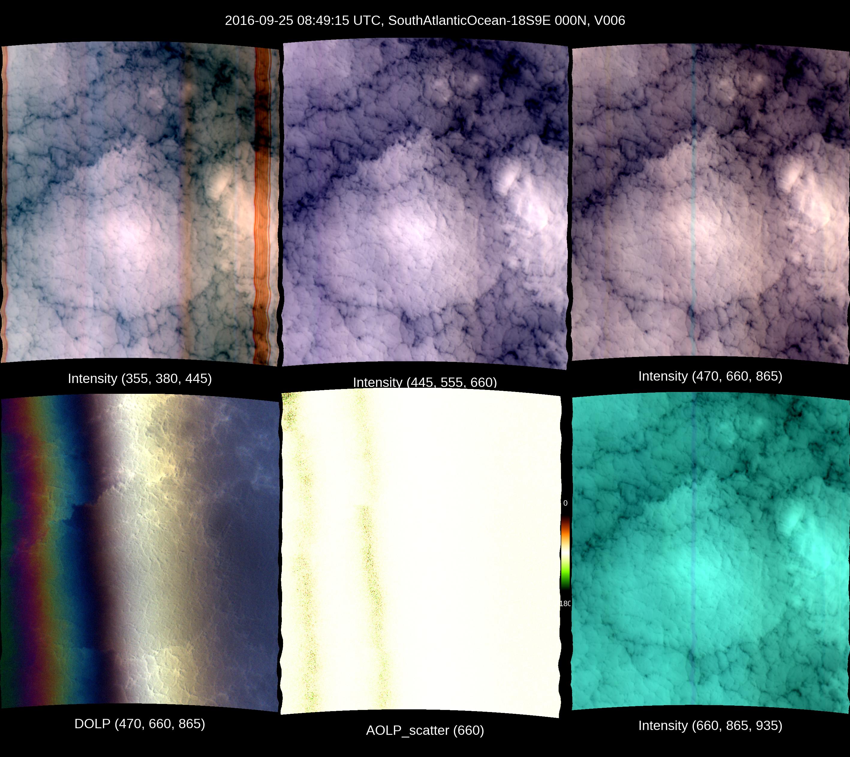
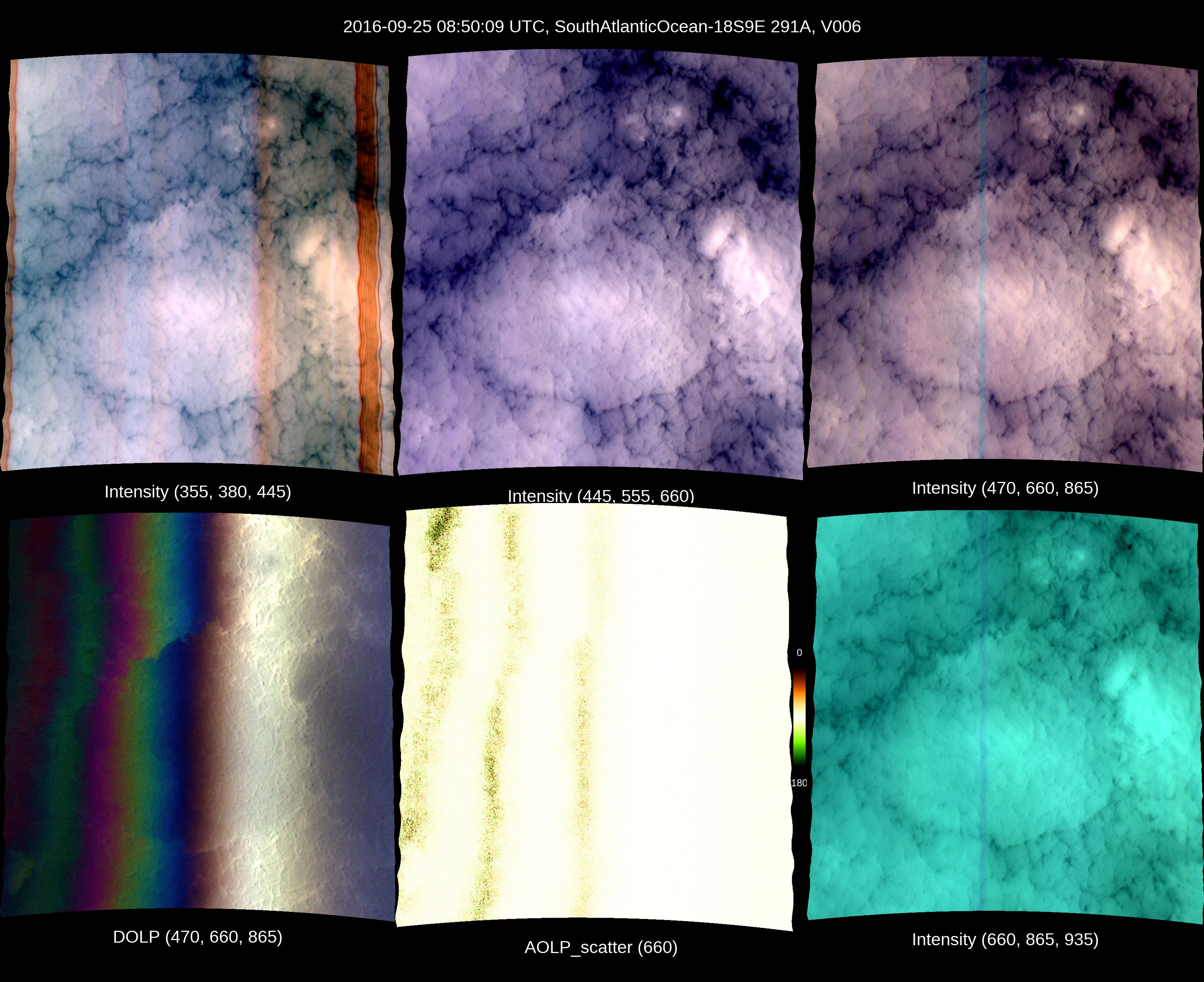
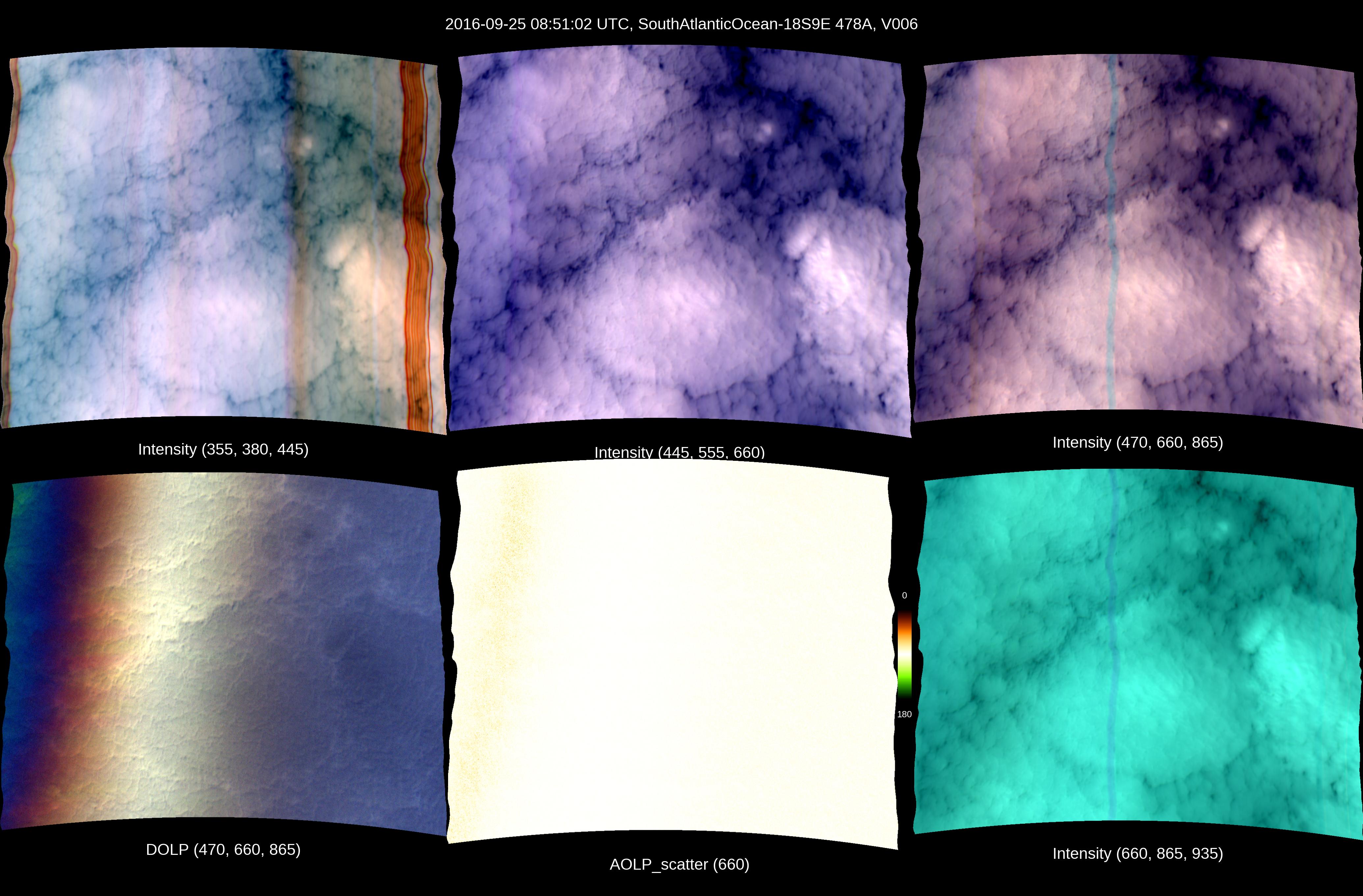
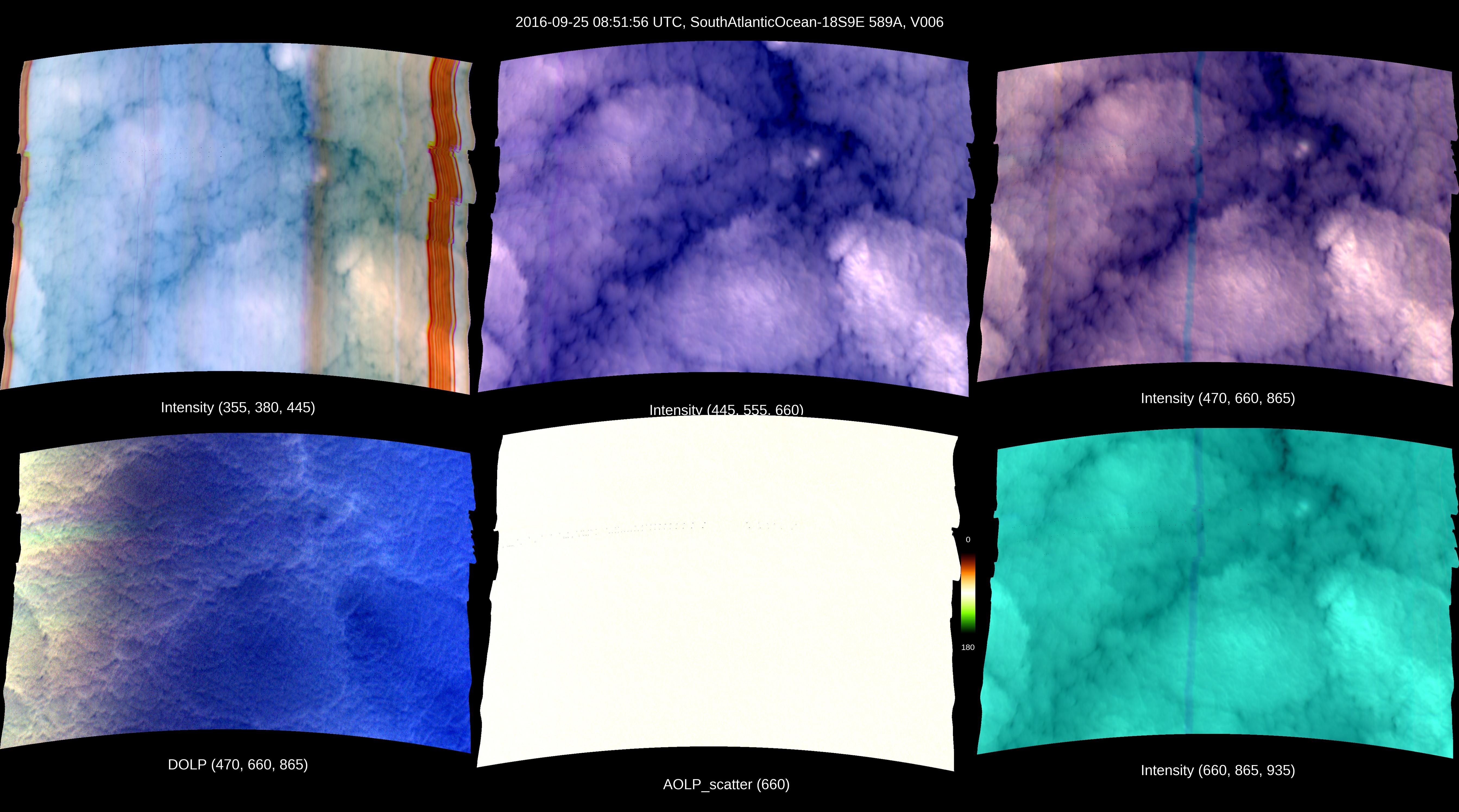
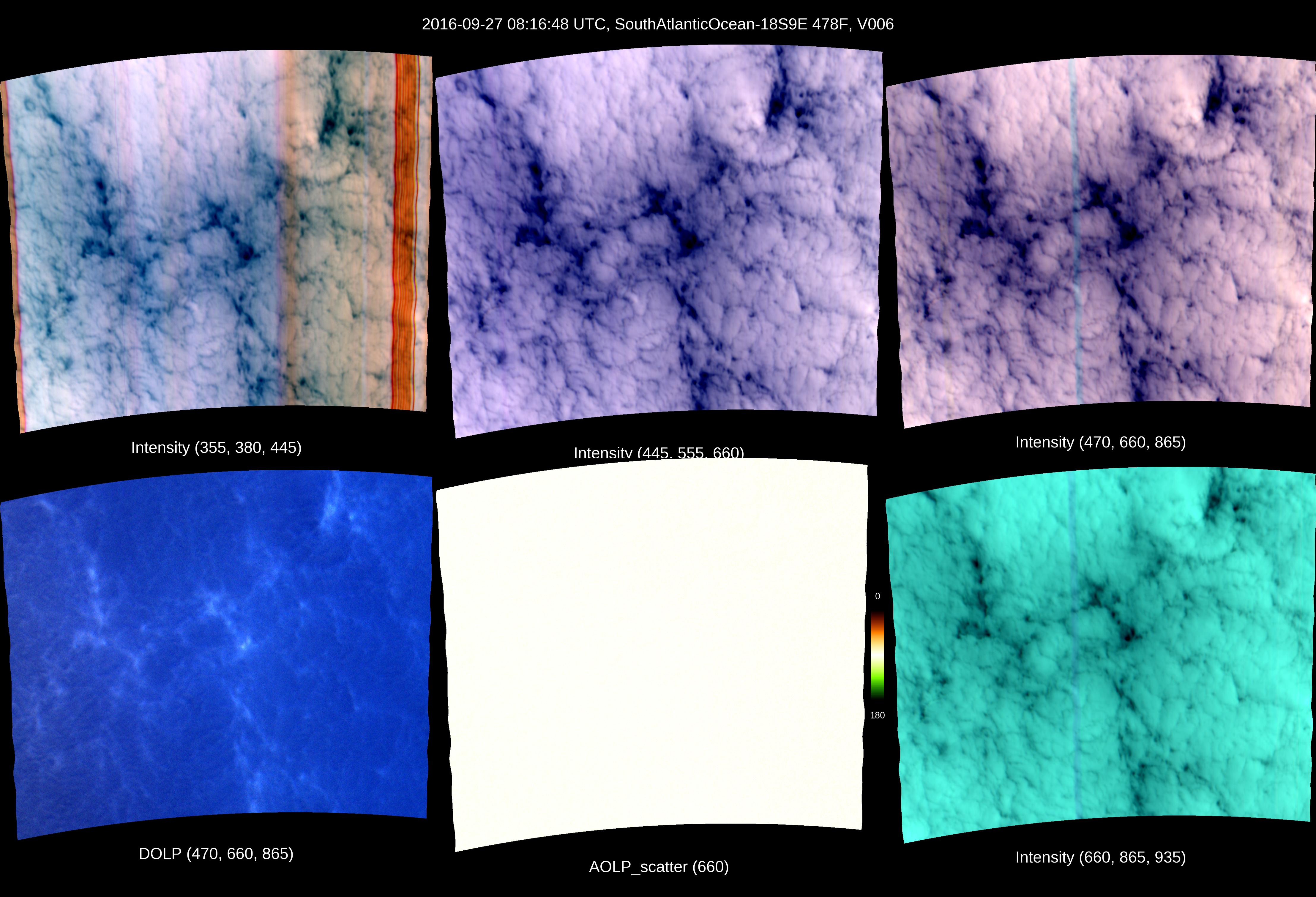
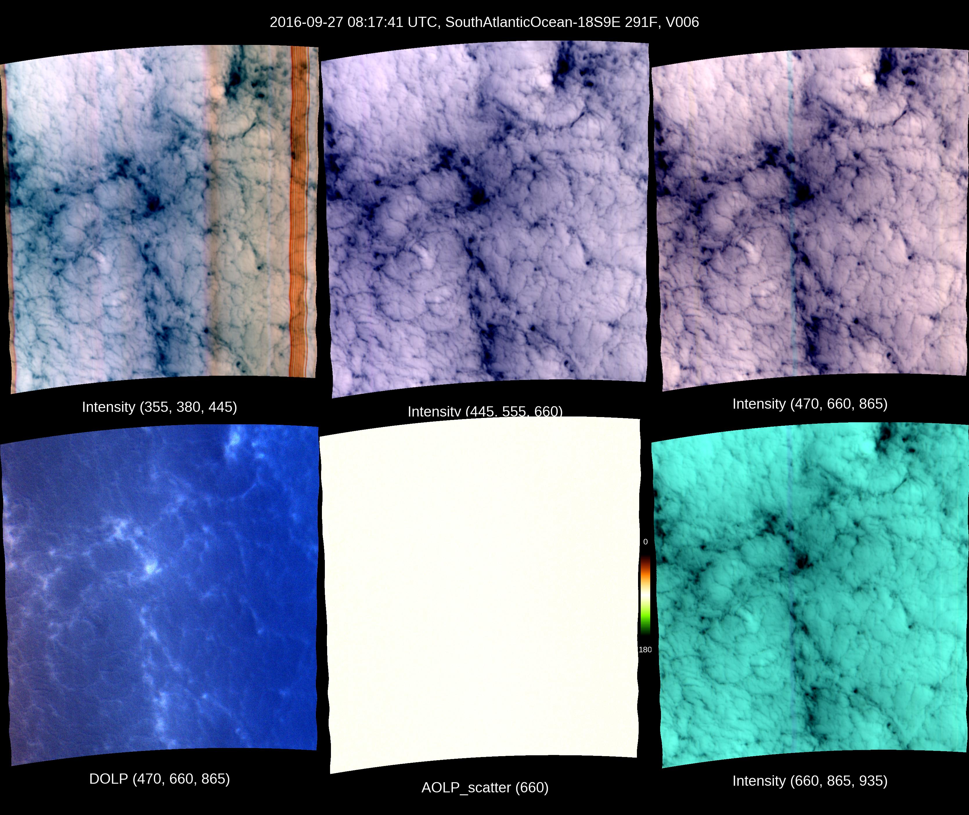
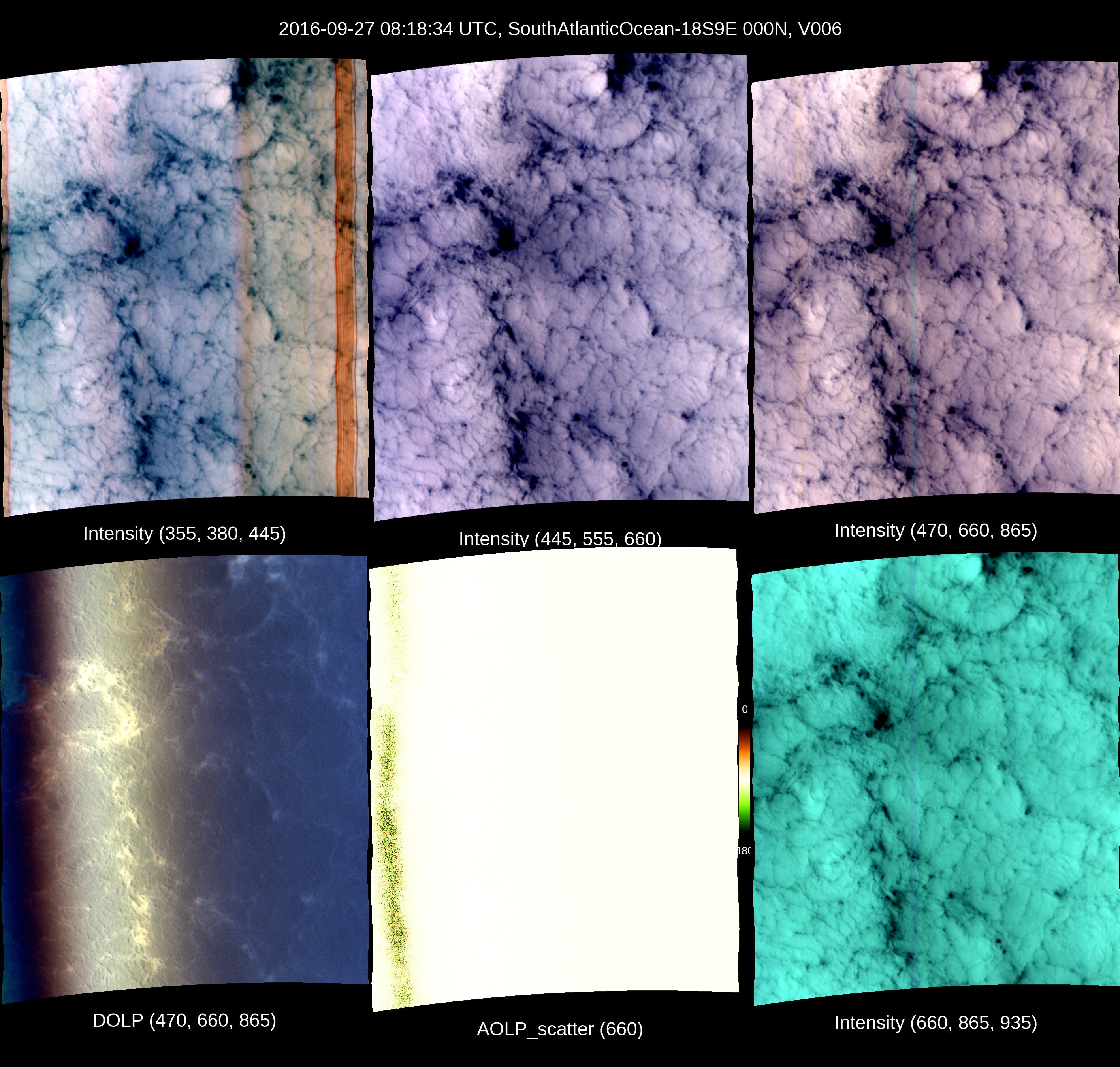
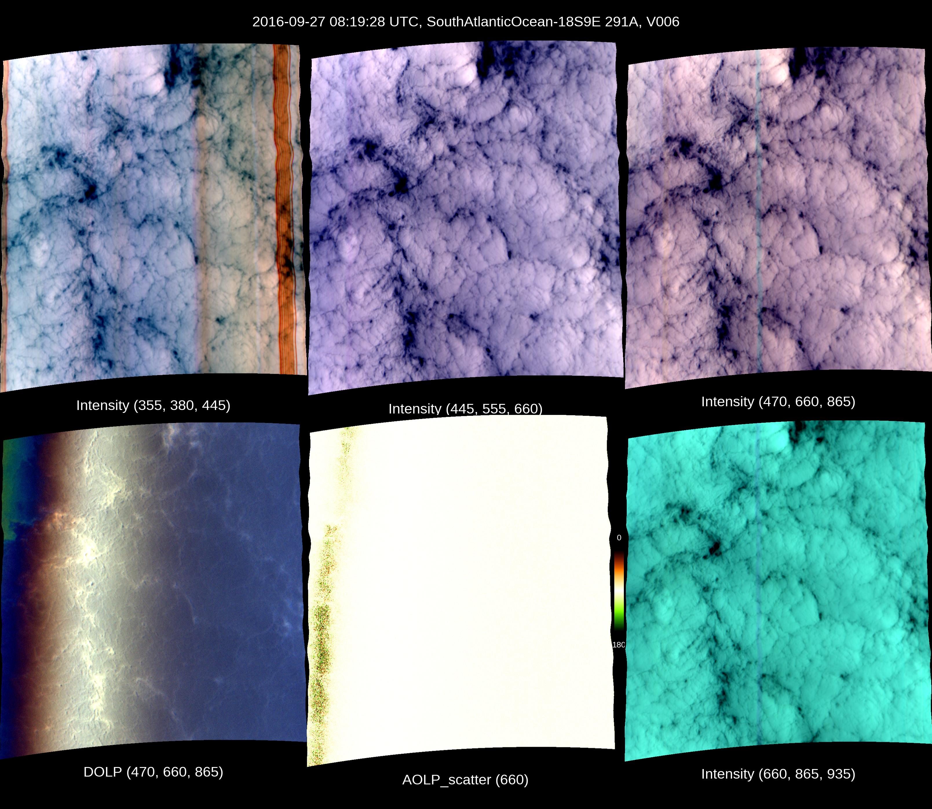
AirMSPI_ORACLES_Cloud_Droplet_Size_and_Cloud_Optical_Depth_1 Imagery

Indirect processing uses an estimate of static pointing errors (i.e. geometric calibration).

Direct processing uses ground control points within the flight line of interest.

SouthAtlanticOcean-18S9E Indirect

20160910 - 082551Z

imagery thumbnail
Full JPG | HDF | KML

SouthAtlanticOcean-18S9E Indirect

20160910 - 082645Z

imagery thumbnail
Full JPG | HDF | KML

SouthAtlanticOcean-18S9E Indirect

20160910 - 082741Z

imagery thumbnail
Full JPG | HDF | KML

SouthAtlanticOcean-18S9E Indirect

20160910 - 082839Z

imagery thumbnail
Full JPG | HDF | KML

SouthAtlanticOcean-18S9E Indirect

20160910 - 082933Z

imagery thumbnail
Full JPG | HDF | KML

SouthAtlanticOcean-18S9E Indirect

20160910 - 083025Z

imagery thumbnail
Full JPG | HDF | KML

SouthAtlanticOcean-18S9E Indirect

20160910 - 083119Z

imagery thumbnail
Full JPG | HDF | KML

SouthAtlanticOcean-18S9E Indirect

20160910 - 083212Z

imagery thumbnail
Full JPG | HDF | KML

SouthAtlanticOcean-18S9E Indirect

20160910 - 083305Z

imagery thumbnail
Full JPG | HDF | KML

SouthAtlanticOcean-18S9E Indirect

20160910 - 083359Z

imagery thumbnail
Full JPG | HDF | KML

SouthAtlanticOcean-18S9E Indirect

20160910 - 083457Z

imagery thumbnail
Full JPG | HDF | KML

SouthAtlanticOcean-18S9E Indirect

20160914 - 102616Z

imagery thumbnail
Full JPG | HDF | KML

SouthAtlanticOcean-18S9E Indirect

20160914 - 102714Z

imagery thumbnail
Full JPG | HDF | KML

SouthAtlanticOcean-18S9E Indirect

20160914 - 102808Z

imagery thumbnail
Full JPG | HDF | KML

SouthAtlanticOcean-18S9E Indirect

20160914 - 102900Z

imagery thumbnail
Full JPG | HDF | KML

SouthAtlanticOcean-18S9E Indirect

20160914 - 102954Z

imagery thumbnail
Full JPG | HDF | KML

SouthAtlanticOcean-18S9E Indirect

20160914 - 103047Z

imagery thumbnail
Full JPG | HDF | KML

SouthAtlanticOcean-18S9E Indirect

20160914 - 103140Z

imagery thumbnail
Full JPG | HDF | KML

SouthAtlanticOcean-18S9E Indirect

20160914 - 103234Z

imagery thumbnail
Full JPG | HDF | KML

SouthAtlanticOcean-18S9E Indirect

20160914 - 103327Z

imagery thumbnail
Full JPG | HDF | KML

SouthAtlanticOcean-18S9E Indirect

20160914 - 104208Z

imagery thumbnail
Full JPG | HDF | KML

SouthAtlanticOcean-18S9E Indirect

20160914 - 104309Z

imagery thumbnail
Full JPG | HDF | KML

SouthAtlanticOcean-18S9E Indirect

20160914 - 104407Z

imagery thumbnail
Full JPG | HDF | KML

SouthAtlanticOcean-18S9E Indirect

20160914 - 104502Z

imagery thumbnail
Full JPG | HDF | KML

SouthAtlanticOcean-18S9E Indirect

20160914 - 104553Z

imagery thumbnail
Full JPG | HDF | KML

SouthAtlanticOcean-18S9E Indirect

20160914 - 104643Z

imagery thumbnail
Full JPG | HDF | KML

SouthAtlanticOcean-18S9E Indirect

20160914 - 104734Z

imagery thumbnail
Full JPG | HDF | KML

SouthAtlanticOcean-18S9E Indirect

20160914 - 104825Z

imagery thumbnail
Full JPG | HDF | KML

SouthAtlanticOcean-18S9E Indirect

20160914 - 104915Z

imagery thumbnail
Full JPG | HDF | KML

SouthAtlanticOcean-18S9E Indirect

20160914 - 105006Z

imagery thumbnail
Full JPG | HDF | KML

SouthAtlanticOcean-18S9E Indirect

20160914 - 105101Z

imagery thumbnail
Full JPG | HDF | KML

SouthAtlanticOcean-18S9E Indirect

20160914 - 113840Z

imagery thumbnail
Full JPG | HDF | KML

SouthAtlanticOcean-18S9E Indirect

20160914 - 113948Z

imagery thumbnail
Full JPG | HDF | KML

SouthAtlanticOcean-18S9E Indirect

20160914 - 114314Z

imagery thumbnail
Full JPG | HDF | KML

SouthAtlanticOcean-18S9E Indirect

20160914 - 114415Z

imagery thumbnail
Full JPG | HDF | KML

SouthAtlanticOcean-18S9E Indirect

20160914 - 114831Z

imagery thumbnail
Full JPG | HDF | KML

SouthAtlanticOcean-18S9E Indirect

20160914 - 114931Z

imagery thumbnail
Full JPG | HDF | KML

SouthAtlanticOcean-18S9E Indirect

20160916 - 082304Z

imagery thumbnail
Full JPG | HDF | KML

SouthAtlanticOcean-18S9E Indirect

20160916 - 082358Z

imagery thumbnail
Full JPG | HDF | KML

SouthAtlanticOcean-18S9E Indirect

20160916 - 082454Z

imagery thumbnail
Full JPG | HDF | KML

SouthAtlanticOcean-18S9E Indirect

20160916 - 082551Z

imagery thumbnail
Full JPG | HDF | KML

SouthAtlanticOcean-18S9E Indirect

20160916 - 082645Z

imagery thumbnail
Full JPG | HDF | KML

SouthAtlanticOcean-18S9E Indirect

20160916 - 082738Z

imagery thumbnail
Full JPG | HDF | KML

SouthAtlanticOcean-18S9E Indirect

20160916 - 082831Z

imagery thumbnail
Full JPG | HDF | KML

SouthAtlanticOcean-18S9E Indirect

20160916 - 082925Z

imagery thumbnail
Full JPG | HDF | KML

SouthAtlanticOcean-18S9E Indirect

20160916 - 083018Z

imagery thumbnail
Full JPG | HDF | KML

SouthAtlanticOcean-18S9E Indirect

20160916 - 083112Z

imagery thumbnail
Full JPG | HDF | KML

SouthAtlanticOcean-18S9E Indirect

20160916 - 083209Z

imagery thumbnail
Full JPG | HDF | KML

SouthAtlanticOcean-18S9E Indirect

20160920 - 104513Z

imagery thumbnail
Full JPG | HDF | KML

SouthAtlanticOcean-18S9E Indirect

20160920 - 104613Z

imagery thumbnail
Full JPG | HDF | KML

SouthAtlanticOcean-18S9E Indirect

20160920 - 121054Z

imagery thumbnail
Full JPG | HDF | KML

SouthAtlanticOcean-18S9E Indirect

20160920 - 121202Z

imagery thumbnail
Full JPG | HDF | KML

SouthAtlanticOcean-18S9E Indirect

20160920 - 121310Z

imagery thumbnail
Full JPG | HDF | KML

SouthAtlanticOcean-18S9E Indirect

20160924 - 135042Z

imagery thumbnail
Full JPG | HDF | KML

SouthAtlanticOcean-18S9E Indirect

20160925 - 084441Z

imagery thumbnail
Full JPG | HDF | KML

SouthAtlanticOcean-18S9E Indirect

20160925 - 084537Z

imagery thumbnail
Full JPG | HDF | KML

SouthAtlanticOcean-18S9E Indirect

20160925 - 084635Z

imagery thumbnail
Full JPG | HDF | KML

SouthAtlanticOcean-18S9E Indirect

20160925 - 084729Z

imagery thumbnail
Full JPG | HDF | KML

SouthAtlanticOcean-18S9E Indirect

20160925 - 084822Z

imagery thumbnail
Full JPG | HDF | KML

SouthAtlanticOcean-18S9E Indirect

20160925 - 084915Z

imagery thumbnail
Full JPG | HDF | KML

SouthAtlanticOcean-18S9E Indirect

20160925 - 085009Z

imagery thumbnail
Full JPG | HDF | KML

SouthAtlanticOcean-18S9E Indirect

20160925 - 085102Z

imagery thumbnail
Full JPG | HDF | KML

SouthAtlanticOcean-18S9E Indirect

20160925 - 085156Z

imagery thumbnail
Full JPG | HDF | KML

SouthAtlanticOcean-18S9E Indirect

20160925 - 085254Z

imagery thumbnail
Full JPG | HDF | KML

SouthAtlanticOcean-18S9E Indirect

20160925 - 085350Z

imagery thumbnail
Full JPG | HDF | KML

SouthAtlanticOcean-18S9E Indirect

20160927 - 081456Z

imagery thumbnail
Full JPG | HDF | KML

SouthAtlanticOcean-18S9E Indirect

20160927 - 081554Z

imagery thumbnail
Full JPG | HDF | KML

SouthAtlanticOcean-18S9E Indirect

20160927 - 081648Z

imagery thumbnail
Full JPG | HDF | KML

SouthAtlanticOcean-18S9E Indirect

20160927 - 081741Z

imagery thumbnail
Full JPG | HDF | KML

SouthAtlanticOcean-18S9E Indirect

20160927 - 081834Z

imagery thumbnail
Full JPG | HDF | KML

SouthAtlanticOcean-18S9E Indirect

20160927 - 081928Z

imagery thumbnail
Full JPG | HDF | KML

SouthAtlanticOcean-18S9E Indirect

20160927 - 082020Z

imagery thumbnail
Full JPG | HDF | KML

SouthAtlanticOcean-18S9E Indirect

20160927 - 082115Z

imagery thumbnail
Full JPG | HDF | KML

SouthAtlanticOcean-18S9E Indirect

20160927 - 082212Z

imagery thumbnail
Full JPG | HDF | KML

SouthAtlanticOcean-18S9E Indirect

20160927 - 082309Z

imagery thumbnail
Full JPG | HDF | KML

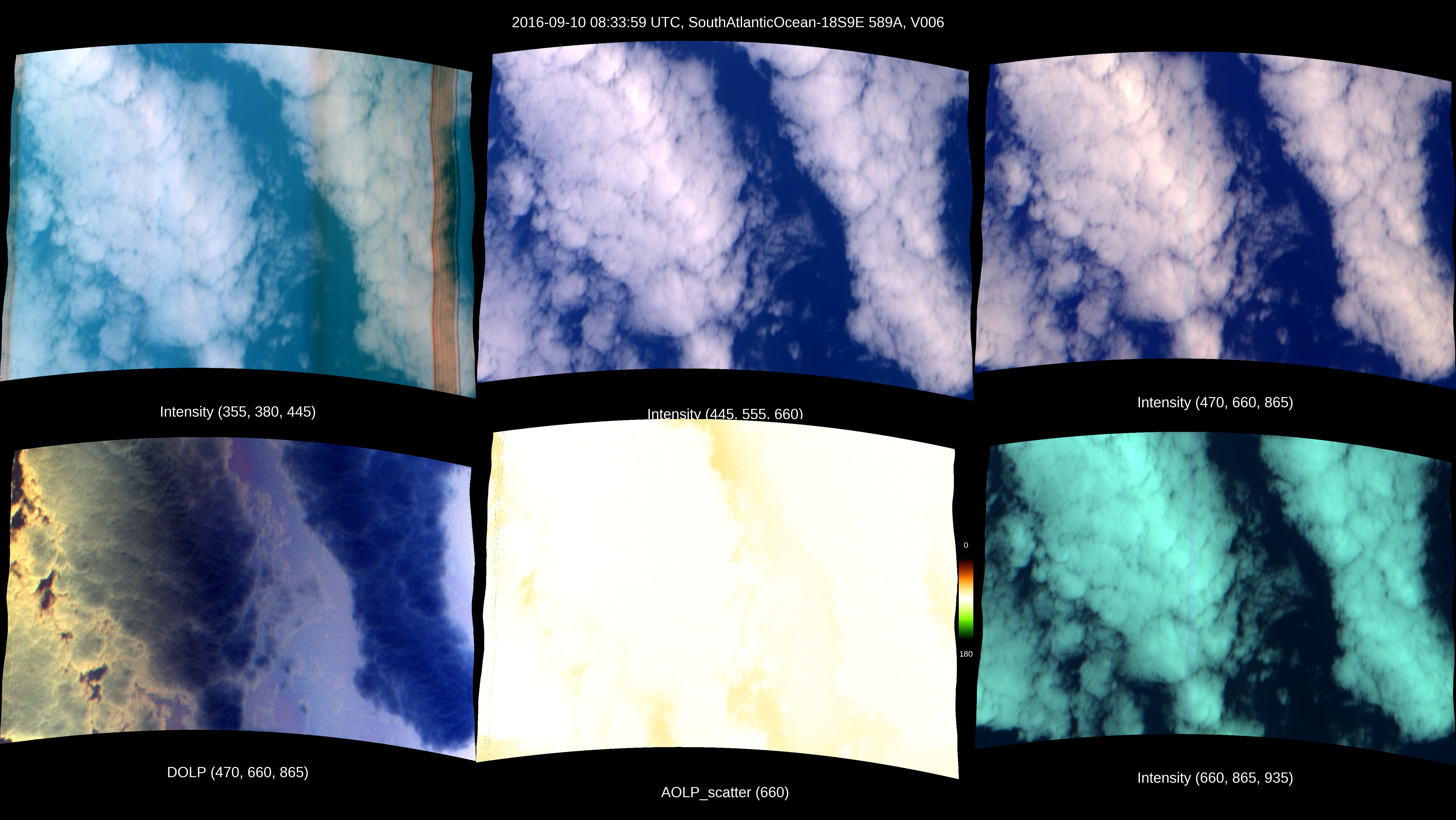
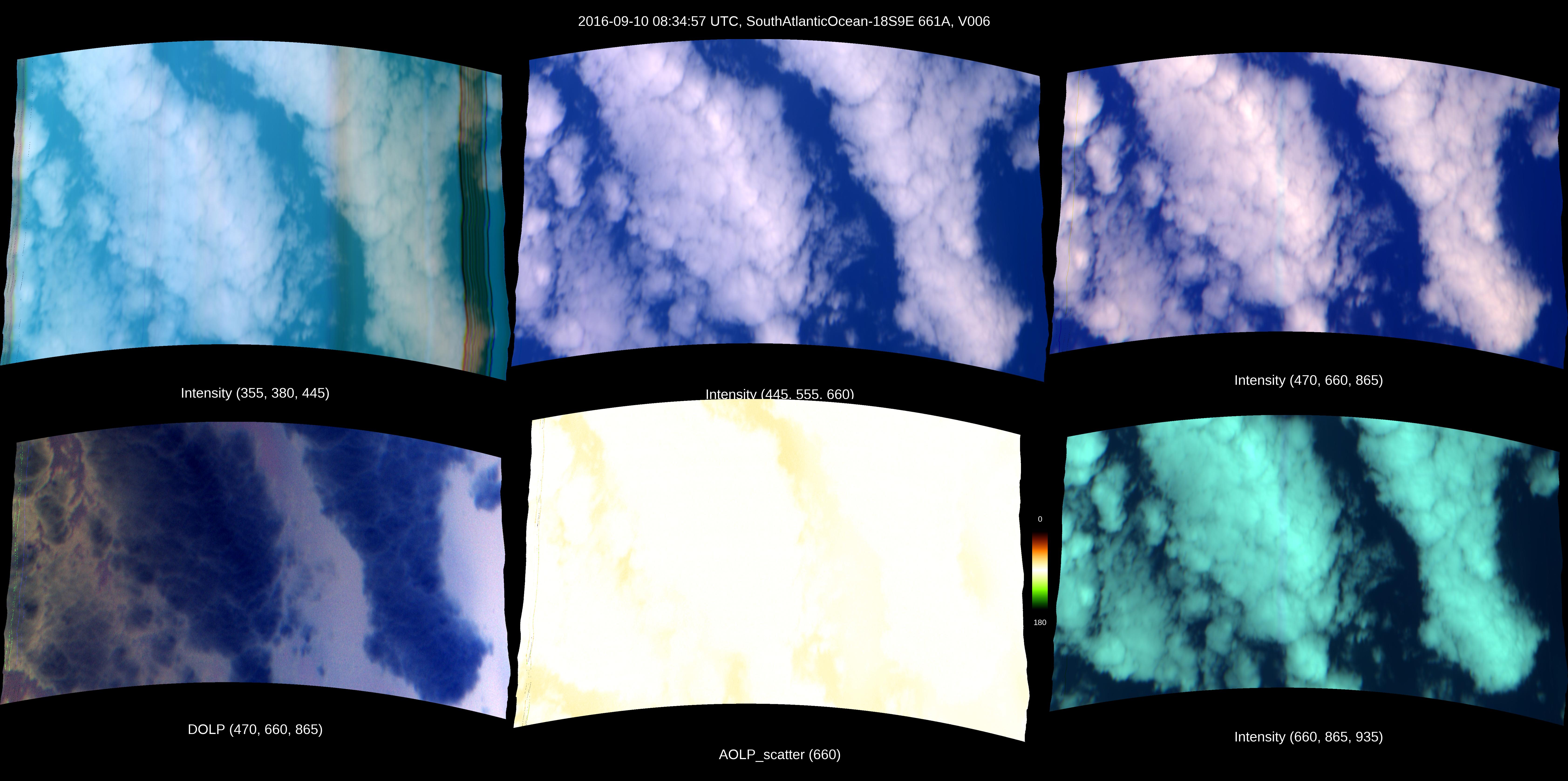
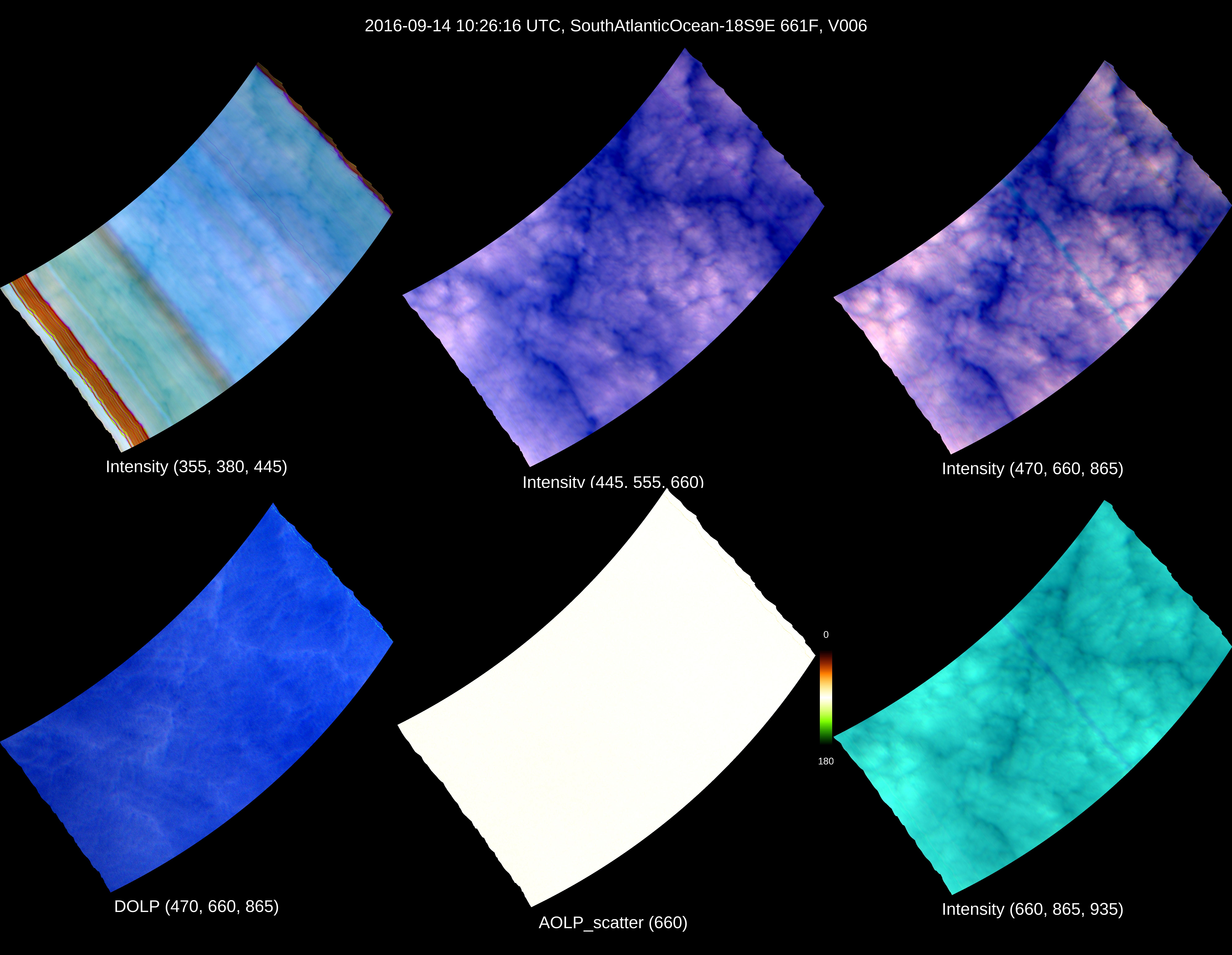
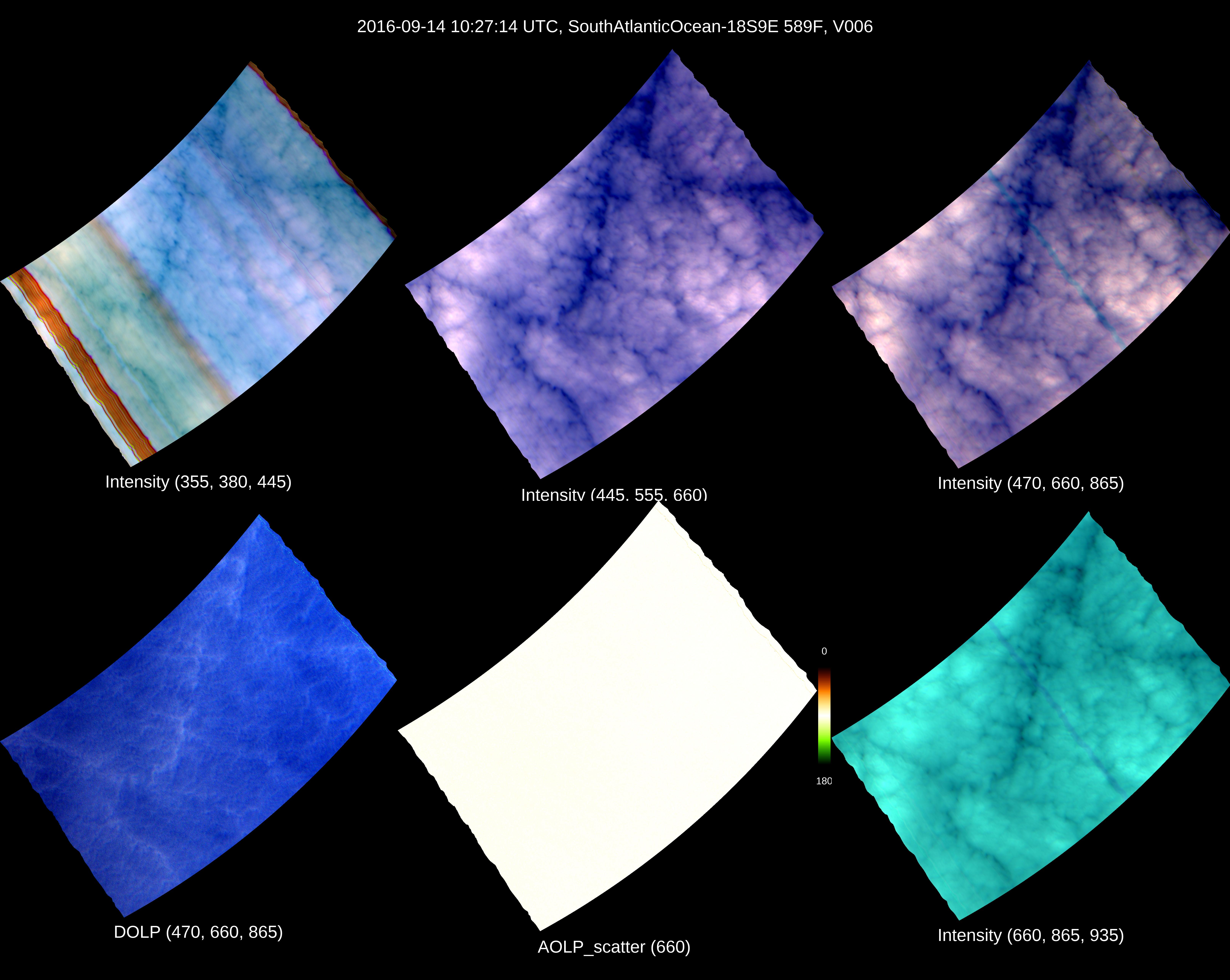
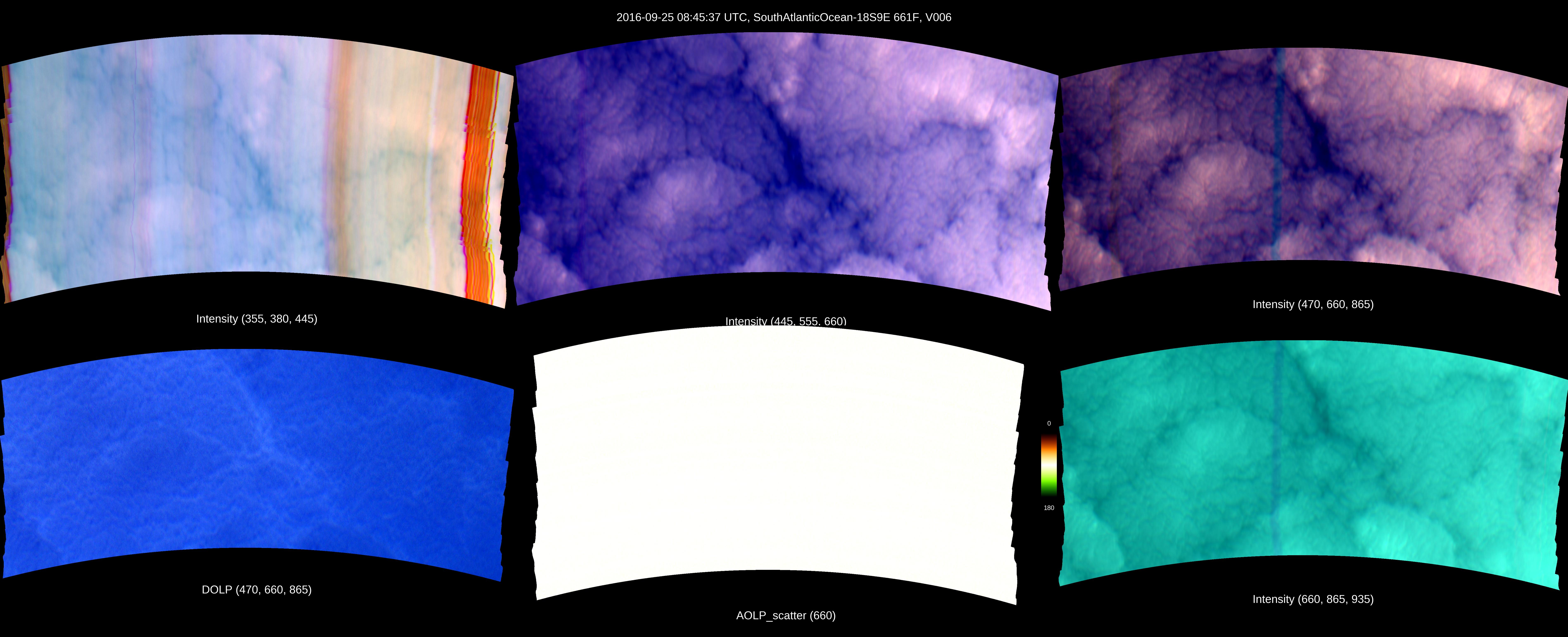
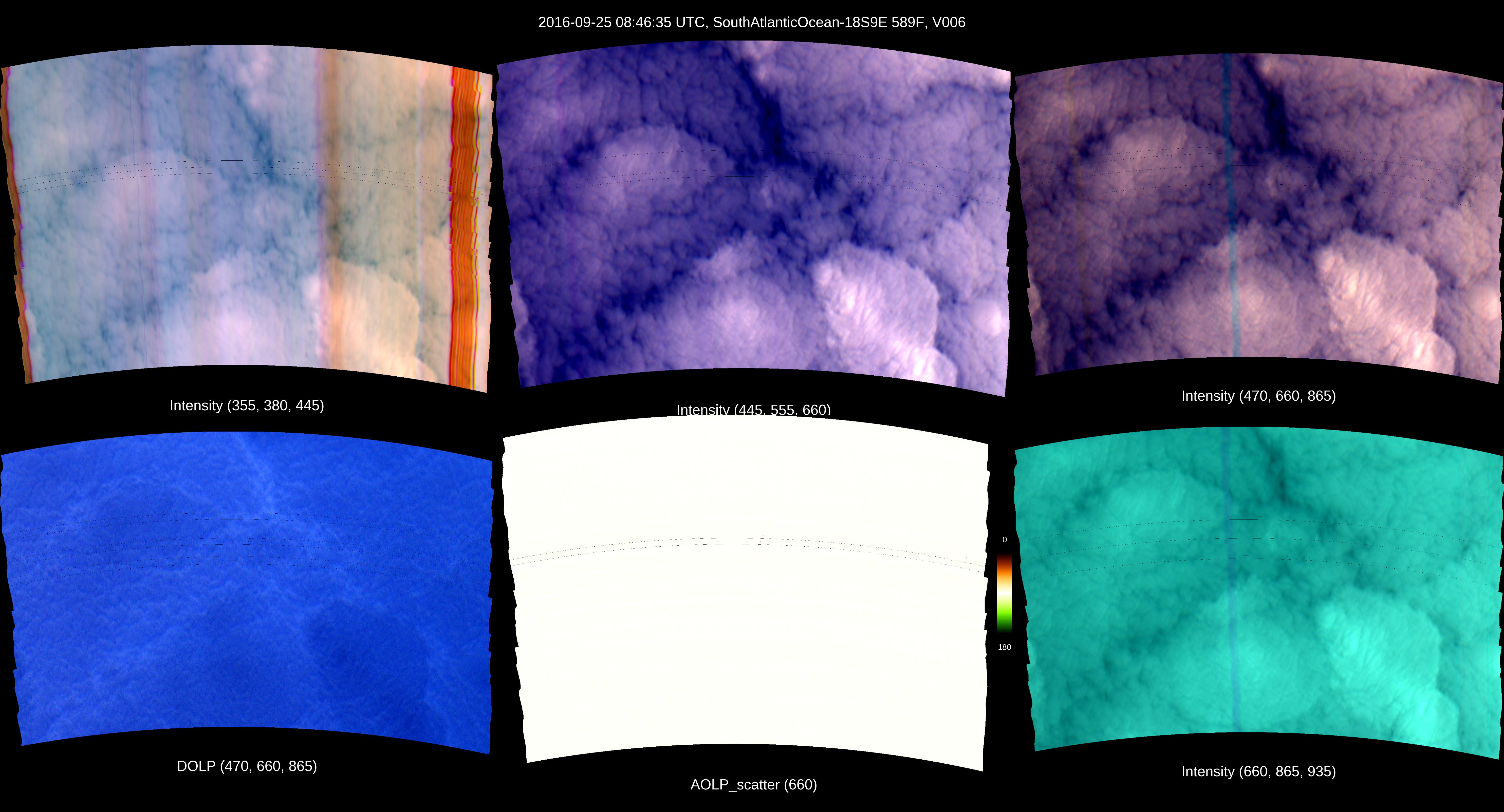
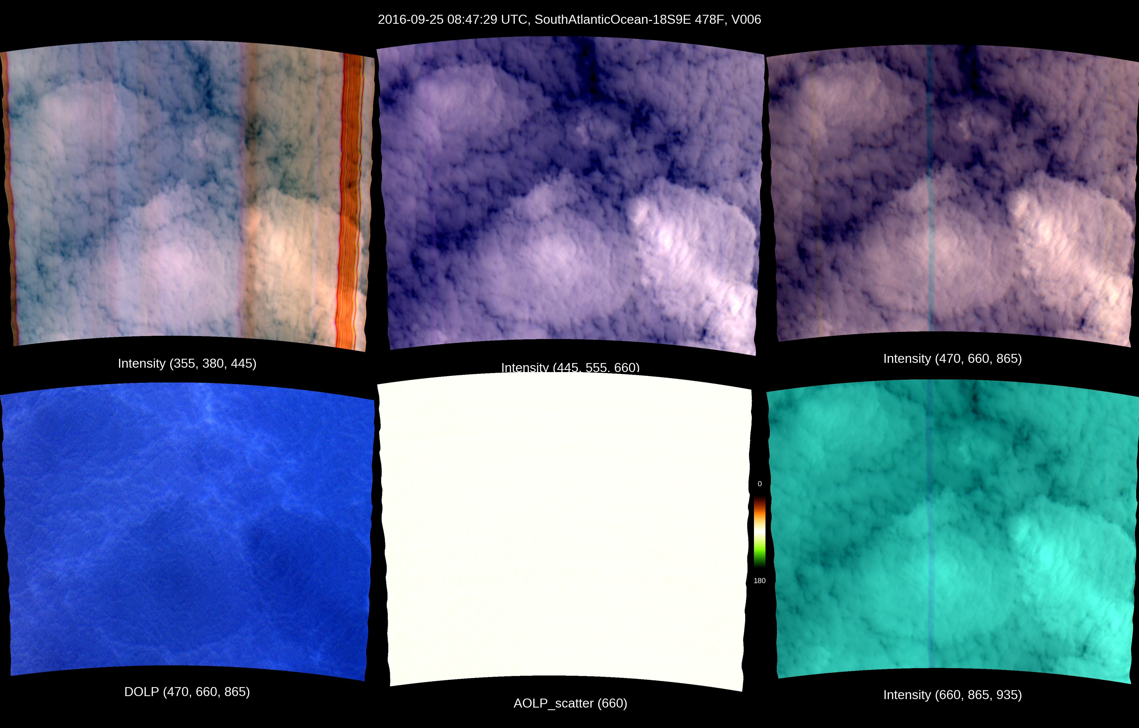
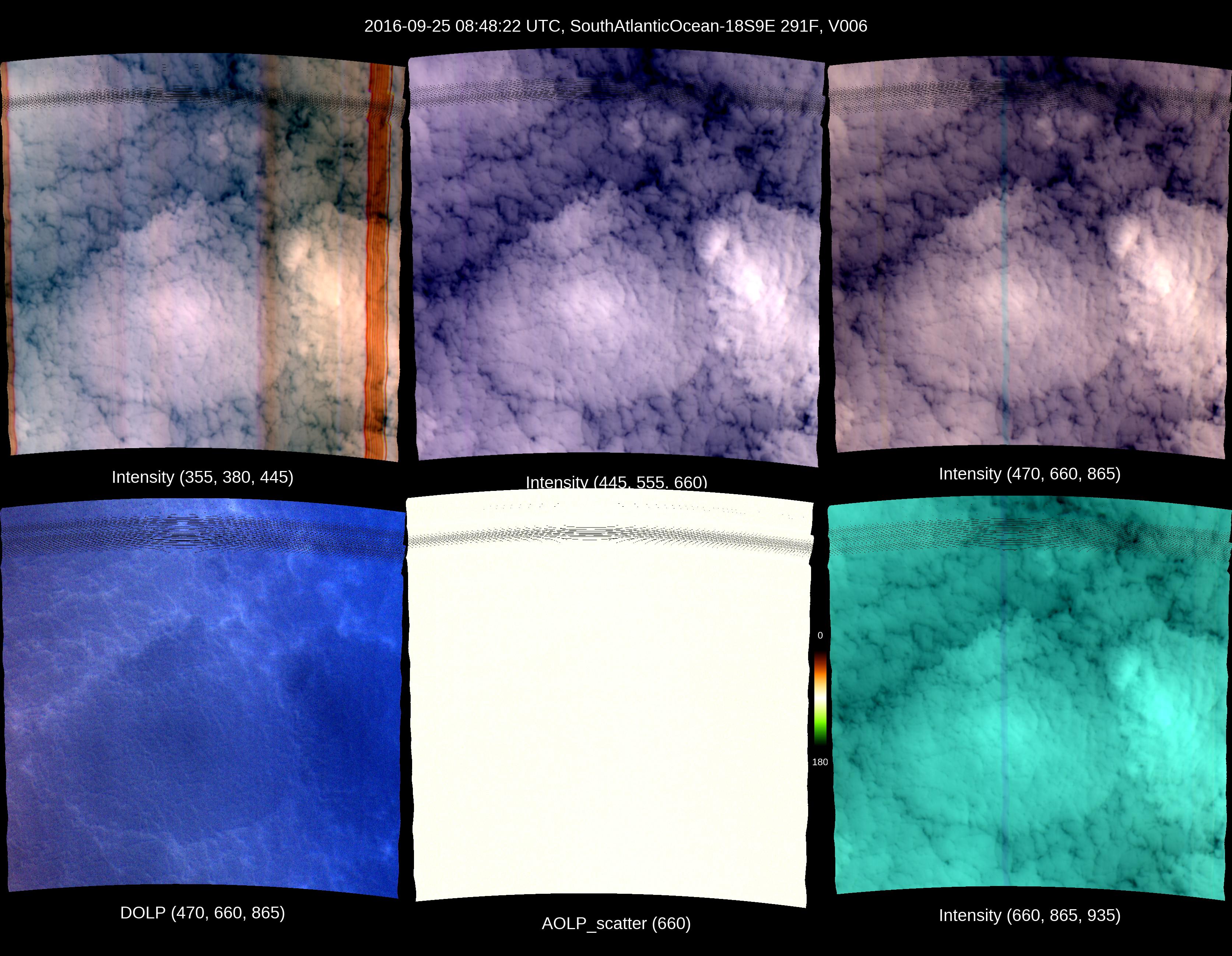
The file name structure is as follows:

AirMSPI_ER2_GRP_ELLIPSOID_yyyymmdd_hhmmssZ_tttt_aaa[A,N,F]_Fff_Vvvv.hdf

or

AirMSPI_ER2_GRP_TERRAIN_yyyymmdd_hhmmssZ_tttt_aaa[A,N,F]_Fff_Vvvv.hdf


yyyymmdd: Year-month-day

hhmmss: Hour-minute-second in UTC of the central observation

tttt: Target name

aaa: Mean viewing angle (reported to the nearest tenth of a degree x 10)

Fff: File format version

Vvvv: Version number

For more information, see the Data Product Specifications (DPS)