Aerosol Characterization from Polarimeter and Lidar
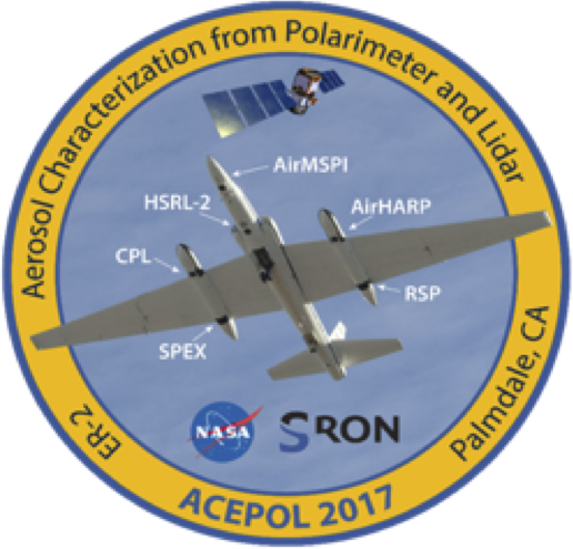
In order to improve our understanding of the effect of aerosols on climate and air quality, measurements of aerosol chemical composition, size distribution, height profile, and optical properties are of crucial importance. In terms of remotely sensed instrumentation, the most extensive set of aerosol properties can be obtained by combining passive multi-angle, multi-spectral measurements of intensity and polarization with active measurements performed by a High Spectral Resolution Lidar. During Fall 2017, the Aerosol Characterization from Polarimeter and Lidar (ACEPOL) campaign, jointly sponsored by NASA and the Netherlands Institute for Space Research (SRON), performed aerosol and cloud measurements over the United States from the NASA high altitude ER-2 aircraft. Six instruments were deployed on the aircraft. Four of these instruments were multi-angle polarimeters: the Airborne Hyper Angular Rainbow Polarimeter (AirHARP), the Airborne Multiangle SpectroPolarimetric Imager (AirMSPI), the Airborne Spectrometer for Planetary Exploration (SPEX Airborne) and the Research Scanning Polarimeter (RSP). The other two instruments were lidars: the High Spectral Resolution Lidar 2 (HSRL-2) and the Cloud Physics Lidar (CPL). The ACEPOL operation was based at NASA’s Armstrong Flight Research Center in Palmdale California, which enabled observations of a wide variety of scene types, including urban, desert, forest, coastal ocean and agricultural areas, with clear, cloudy, polluted and pristine atmospheric conditions. The primary goal of ACEPOL was to assess the capabilities of the different polarimeters for retrieval of aerosol and cloud microphysical and optical parameters, as well as their capabilities to derive aerosol layer height (near-UV polarimetry, O2 A-band). ACEPOL also focused on the development and evaluation of aerosol retrieval algorithms that combine data from both active (lidar) and passive (polarimeter) instruments. ACEPOL data are appropriate for algorithm development and testing, instrument intercomparison, and investigations of active and passive instrument data fusion, which make them valuable resources for remote sensing communities as they prepare for the next generation of spaceborne MAP and lidar missions.
(Credit: Kirk Knobelspiesse, NASA GSFC; https://www-air.larc.nasa.gov/missions/acepol/index.html, https://www.nwo.nl/en/research-and-results/research-projects/i/77/27477.html)
Project DOI: 10.5067/SUBORBITAL/ACEPOL2017/DATA001
Documentation:
For more information regarding the Airborne Multi-angle SpectroPolarimetric Imager (AirMSPI) data collected during ACEPOL, please refer to: AirMSPI ACEPOL Ellipsoid Data, AirMSPI ACEPOL Terrain Data, and GroundMSPI Radiance Products.Disciplines: Field Campaigns
| Collection | Disciplines | Spatial | Temporal |
|---|---|---|---|
|
ACEPOL_AircraftRemoteSensing_AirHARP_Data_1
ACEPOL Airborne Hyper Angular Rainbow Polarimeter (AirHARP) Remotely Sensed Data Version 1 |
Aerosols, Clouds |
Spatial Coverage: (S: 25, N: 45), (W: -130, E: -100) |
Temporal Coverage: 2017-10-18 - 2020-11-20 |
|
ACEPOL_AircraftRemoteSensing_AirSPEX_Data_1
ACEPOL Airborne Spectrometer for Planetary Exploration (AirSPEX) Remotely Sensed Data Version 1 |
Aerosols, Clouds |
Spatial Coverage: (S: 25, N: 45), (W: -130, E: -100) |
Temporal Coverage: 2017-10-19 - 2017-11-09 |
|
ACEPOL_AircraftRemoteSensing_CPL_Data_1
ACEPOL Cloud Physics Lidar (CPL) Remotely Sensed Data Version 1 |
Aerosols, Clouds |
Spatial Coverage: (S: 25, N: 45), (W: -130, E: -100) |
Temporal Coverage: 2017-10-19 - 2017-11-09 |
|
ACEPOL_AircraftRemoteSensing_HSRL2_Data_1
ACEPOL High Spectral Resolution Lidar 2 (HSRL-2) Remotely Sensed Data |
Aerosols, Clouds |
Spatial Coverage: (S: 25, N: 45), (W: -130, E: -100) |
Temporal Coverage: 2017-10-23 - 2017-11-09 |
|
ACEPOL_AircraftRemoteSensing_RSP_Data_1
ACEPOL Research Scanning Polarimeter (RSP) Remotely Sensed Data Version 1 |
Aerosols, Clouds |
Spatial Coverage: (S: 25, N: 45), (W: -130, E: -100) |
Temporal Coverage: 2017-10-23 - 2017-11-09 |
|
ACEPOL_MetNav_AircraftInSitu_Data_1
ACEPOL ER-2 Meteorological and Navigational Data Version 1 |
Field Campaigns |
Spatial Coverage: (S: 25, N: 45), (W: -130, E: -100) |
Temporal Coverage: 2017-10-19 - 2017-11-09 |
ACEPOL Mission Publications
McBride, Brent A.; Martins, J. Vanderlei; Cieslak, J. Dominik; Fernandez-Borda, Roberto; Puthukkudy, Anin; Xu, Xiaoguang; Sienkiewicz, Noah; Cairns, Brian; Barbosa, Henrique M. J. (2024). Pre-launch calibration and validation of the Airborne Hyper-Angular Rainbow Polarimeter (AirHARP) instrument.
Hannadige, Neranga K.; Zhai, Peng-Wang; Gao, Meng; Hu, Yongxiang; Werdell, P. Jeremy; Knobelspiesse, Kirk; Cairns, Brian (2023). Performance evaluation of three bio-optical models in aerosol and ocean color joint retrievals.
Gao, Meng; Knobelspiesse, Kirk; Franz, Bryan A.; Zhai, Peng-Wang; Cairns, Brian; Xu, Xiaoguang; Martins, J. Vanderlei (2023). The impact and estimation of uncertainty correlation for multi-angle polarimetric remote sensing of aerosols and ocean color.
McLean, William G. K.; Fu, Guangliang; Burton, Sharon P.; Hasekamp, Otto P. (2022). Retrieval of aerosol microphysical properties from atmospheric lidar sounding: an investigation using synthetic measurements and data from the ACEPOL campaign. Atmospheric Measurement Techniques, 14 (6), https://doi.org/10.5194/amt-14-4755-2021
Fu, Guangliang; Hasekamp, Otto; Rietjens, Jeroen; Smit, Martijn; Di Noia, Antonio; Cairns, Brian; Wasilewski, Andrzej; Diner, David; Seidel, Felix; Xu, Feng; Knobelspiesse, Kirk; Gao, Meng; da Silva, Arlindo; Burton, Sharon; Hostetler, Chris; Hair, John; Ferrare, Richard (2021). Aerosol retrievals from different polarimeters during the ACEPOL campaign using a common retrieval algorithm. Atmospheric Measurement Techniques, 13 (2), https://doi.org/10.5194/amt-13-553-2020
Puthukkudy, Anin; Martins, J. Vanderlei; Remer, Lorraine A.; Xu, Xiaoguang; Dubovik, Oleg; Litvinov, Pavel; McBride, Brent; Burton, Sharon; Barbosa, Henrique M. J. (2020). Retrieval of aerosol properties from Airborne Hyper-Angular Rainbow Polarimeter (AirHARP) observations during ACEPOL 2017. Atmospheric Measurement Techniques, 13 (10), https://doi.org/10.5194/amt-13-5207-2020
Gao, Meng; Zhai, Peng-Wang; Franz, Bryan A.; Knobelspiesse, Kirk; Ibrahim, Amir; Cairns, Brian; Craig, Susanne E.; Fu, Guangliang; Hasekamp, Otto; Hu, Yongxiang; Werdell, P. Jeremy (2020). Inversion of multiangular polarimetric measurements from the ACEPOL campaign: an application of improving aerosol property and hyperspectral ocean color retrievals. Atmospheric Measurement Techniques, 13 (7), https://doi.org/10.5194/amt-13-3939-2020
Gao, Meng; Franz, Bryan A.; Knobelspiesse, Kirk; Zhai, Peng-Wang; Martins, Vanderlei; Burton, Sharon; Cairns, Brian; Ferrare, Richard; Gales, Joel; Hasekamp, Otto; Hu, Yongxiang; Ibrahim, Amir; McBride, Brent; Puthukkudy, Anin; Werdell, P. Jeremy; Xu, Xiaoguang (2020). Efficient multi-angle polarimetric inversion of aerosols and ocean color powered by a deep neural network forward model. Atmospheric Measurement Techniques, 14 (6), https://doi.org/10.5194/amt-14-4083-2021
Fan, Cheng; Fu, Guangliang; Di Noia, Antonio; Smit, Martijn; H.H. Rietjens, Jeroen; A. Ferrare, Richard; Burton, Sharon; Li, Zhengqiang; P. Hasekamp, Otto (2020). Use of A Neural Network-Based Ocean Body Radiative Transfer Model for Aerosol Retrievals from Multi-Angle Polarimetric Measurements. Remote Sensing, 11 (23), https://doi.org/10.3390/rs11232877
Fu, Guangliang; Hasekamp, Otto; Rietjens, Jeroen; Smit, Martijn; Di Noia, Antonio; Cairns, Brian; Wasilewski, Andrzej; Diner, David; Xu, Feng; Knobelspiesse, Kirk; Gao, Meng; da Silva, Arlindo; Burton, Sharon; Hostetler, Chris; Hair, John; Ferrare, Richard (2020). Aerosol retrievals from the ACEPOL Campaign. Atmospheric Measurement Techniques, https://doi.org/10.5194/amt-2019-287
Fu, Guangliang; Hasekamp, Otto (2019). Retrieval of aerosol microphysical and optical properties over land using a multimode approach. Atmospheric Measurement Techniques, 11 (12), https://doi.org/10.5194/amt-11-6627-2018
Ottaviani, Matteo; Chowdhary, Jacek; Cairns, Brian (2019). Remote sensing of the ocean surface refractive index via short-wave infrared polarimetry. Remote Sensing of Environment, 221 https://doi.org/10.1016/j.rse.2018.10.016
Martins, J. Vanderlei; Fernandez-Borda, Roberto; McBride, Brent; Remer, Lorraine; Barbosa, Henrique M. J. (2019). The Harp Hype Ran Gular Imaging Polarimeter and the Need for Small Satellite Payloads with High Science Payoff for Earth Science Remote Sensing. IEEE International Geoscience and Remote Sensing Symposium, https://doi.org/10.1109/IGARSS.2018.8518823
Knobelspiesse, Kirk; Barbosa, Henrique M. J.; Bradley, Christine; Bruegge, Carol; Cairns, Brian; Chen, Gao; Chowdhary, Jacek; Cook, Anthony; Di Noia, Antonio; van Diedenhoven, Bastiaan; Diner, David J.; Ferrare, Richard; Fu, Guangliang; Gao, Meng; Garay, Michael; Hair, Johnathan; Harper, David; van Harten, Gerard; Hasekamp, Otto; Helmlinger, Mark; Hostetler, Chris; Kalashnikova, Olga; Kupchock, Andrew; Longo De Freitas, Karla; Maring, Hal; Martins, J. Vanderlei; McBride, Brent; McGill, Matthew; Norlin, Ken; Puthukkudy, Anin; Rheingans, Brian; Rietjens, Jeroen; Seidel, Felix C.; da Silva, Arlindo; Smit, Martijn; Stamnes, Snorre; Tan, Qian; Val, Sebastian; Wasilewski, Andrzej; Xu, Feng; Xu, Xiaoguang; Yorks, John (2018). The Aerosol Characterization from Polarimeter and Lidar (ACEPOL) airborne field campaign. Earth System Science Data, 12 (3), 2183. https://doi.org/10.5194/essd-12-2183-2020
Gao, Meng; Knobelspiesse, Kirk; Franz, Bryan A.; Zhai, Peng-Wang; Sayer, Andrew M.; Ibrahim, Amir; Cairns, Brian; Hasekamp, Otto; Hu, Yongxiang; Martins, Vanderlei; Werdell, P. Jeremy; Xu, Xiaoguang (2015). Effective uncertainty quantification for multi-angle polarimetric aerosol remote sensing over ocean.